

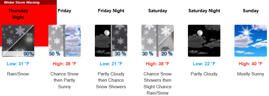
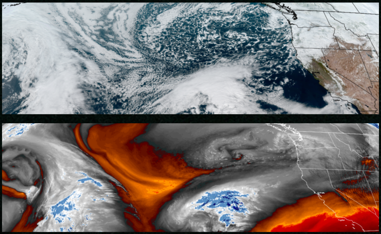
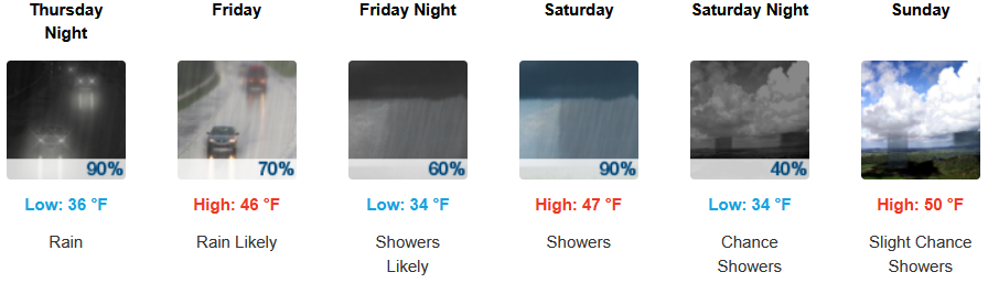
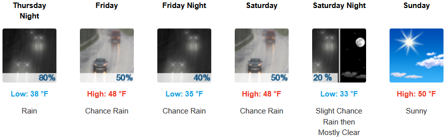
Winter Storm Warnings issued by the National Weather Service remain in the forecast to close the work week as a mass of unstable air works itself onshore and the ‘atmospheric river’ impacting northern California and southern Oregon through the weekend.
Inland areas are expected to see rain an snow to start the workweek and continuing through mid week with snow levels reaching the valley floor. Low temperatures are expected to range from the low 20’s to low 30’s with afternoon highs only getting to the mid to upper 30’s.
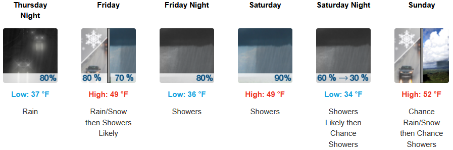
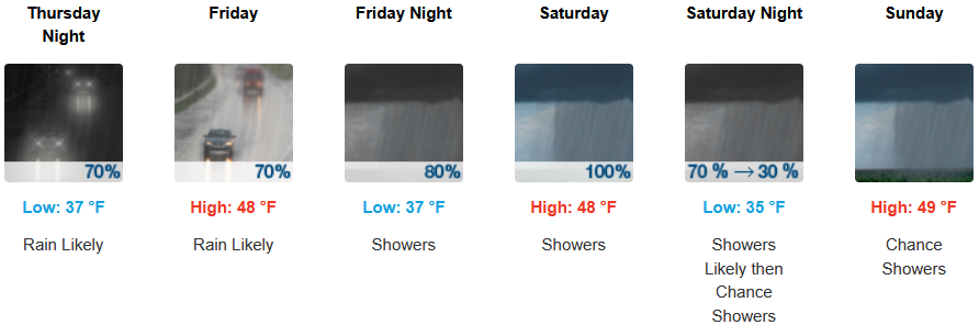
Along the coast, rain with the possibility of localized thunder storms is expected to impact much of the area with southern Oregon at the top edge of the atmospheric river affecting northern California with snow levels possibly dropping as low as sea level before skies possibly begin to clear late in the weekend. Temperatures are forecast to be in the mid 40’s for afternoon highs with lows cooling to the low to upper 30’s through midweek.
Brookings:
Crescent City:
Gold Beach:
Port Orford:
Cave Junction:
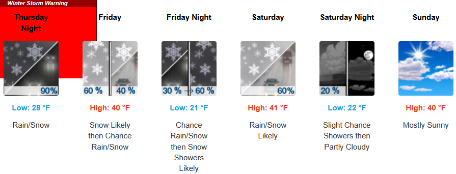
Grants Pass:
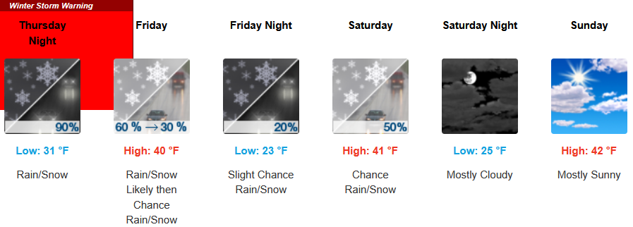
Medford: