

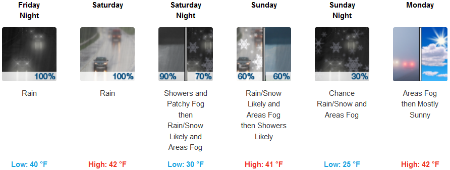
A new cold weather system has moved into the area Thursday afternoon, ushering in an new round of rain, wind and continued cold temperatures dropping snow levels at higher elevations. Another, stronger system is forecast to follow as early as Friday, and is expected to produce heavy mountain snows, especially along the Cascades, Siskiyous, and Mt. Shasta area, where 1 to 2 feet of snow is possible Friday through Saturday.
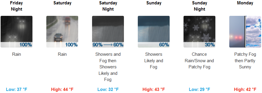
Inland areas can expect to see rain continuing Thursday night into Friday as another system begins to move onshore. The system forecast for Friday and continuing through much of the weekend is expected to drop snow levels across many of the mountain passes to get as low as 2500 ft., with accumulation of heavy mountain snows, especially along the Cascades, Siskiyous, and Mt. Shasta area, where 1 to 2 feet of snow is possible Friday through Saturday. Low temperatures are forecast to be in the low to mid 30’s, dropping to the mid 20’s by Monday.
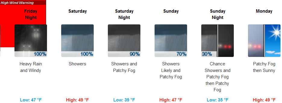
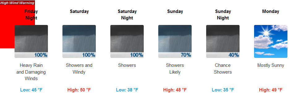
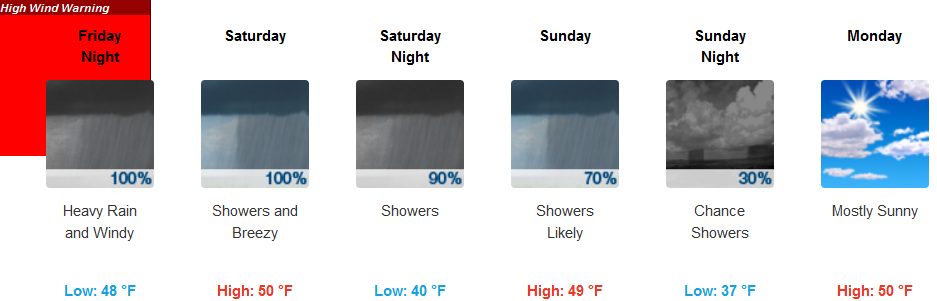
Storm Warnings and High Wind Warnings have been issued by the National Weather Service for much of the coast. Showers are expected to continue into Friday morning before another round of rain moves onshore Friday afternoon, bringing bouts of heavy rain and the possibility of thunderstorms. Temperatures are expected to remain relatively cool throughout the weekend with highs in the mid to upper 40’s and lows in the mid 30’s.
Brookings:
Crescent City:
Gold Beach:
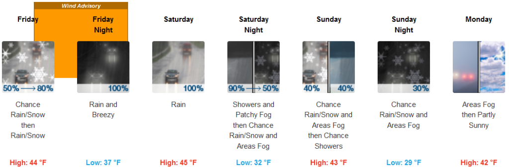
Cave Junction:
Grants Pass:
Medford: