

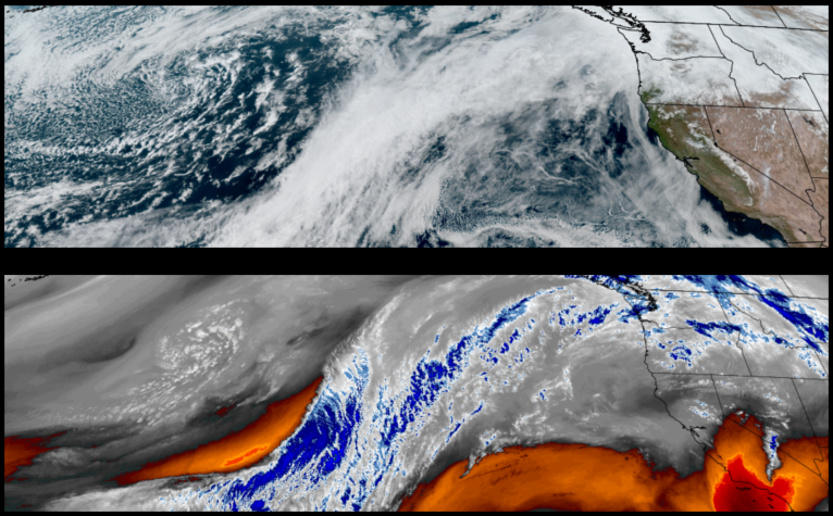
A ridge of high pressure off the coast is expected to push active weather systems to the north, providing mostly clear skies and spring like temperatures to start the work week. However, more rain is in the forecast by mid week.
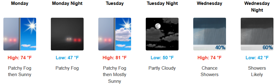
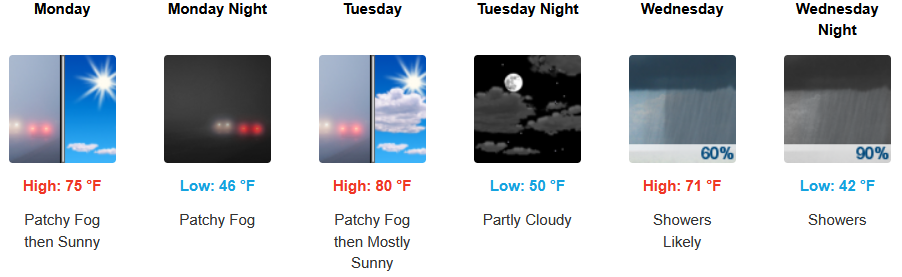
Inland areas can expect early morning patchy localized fog under mostly clear skies to start the week before another wet weather system moves over the region midweek. Early morning lows are expected to be in the upper 40’s to low 50’s with highs likely reaching the upper 70’s to low 80’s.
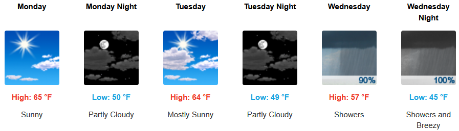
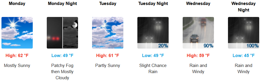
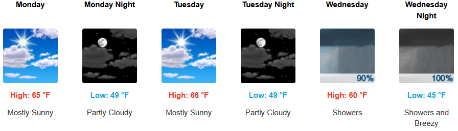
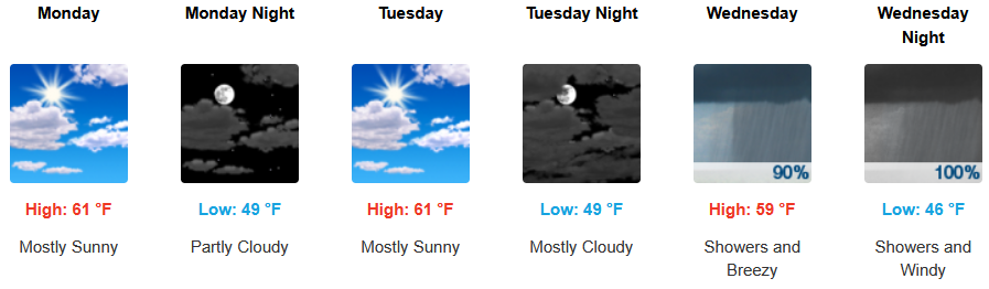
Along the coast, mostly sunny skies are expected to continue into mid week before another set of low pressure system’s move onshore with rain as early as Wednesday. Temperatures are forecast to consistently be in the mid 60’s for afternoon highs with morning lows cooling to the low to mid 40’s.
Brookings:
Crescent City:
Gold Beach:
Port Orford:
Grants Pass:
Medford: