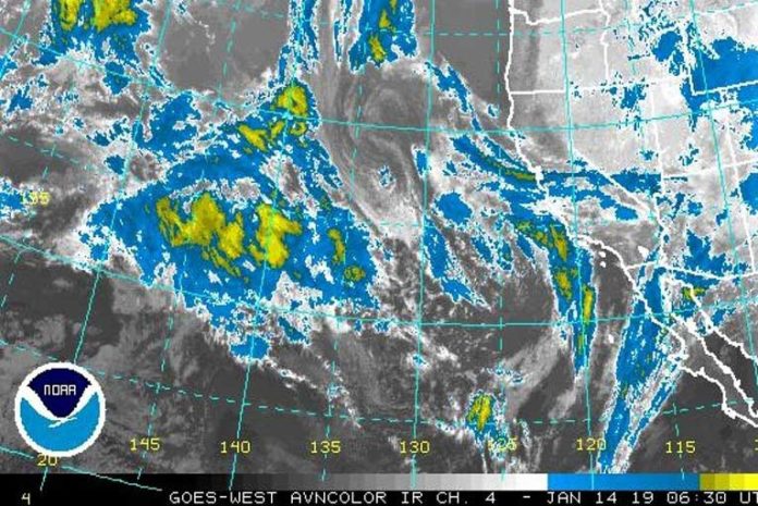
A very active week is coming up for the West Coast. A large closed upper level low will initially usher waves of Pacific moisture into California through Tuesday. Ahead of this storm, there will be some weaker weather systems with occasional rainfall, but the most significant system is expected Wednesday night.
On Wednesday into Thursday, a powerful storm system will plow into the entire West Coast. Overall, expect heavy rain, mountain snow, gusty winds, rough surf and possible flooding, especially near recent wildfire burn scars.
Brookings:

Medford:

A strong storm system is expected to generate hazardous ocean conditions late Wednesday and Thursday throughout the waters, due to a combination of Gale force southerly winds and a large westerly swell. Significant wave heights are expected to reach 25 feet and potentially higher, which will lead to increased shoaling and an overall hazardous and chaotic sea state.

Meanwhile, large breaking waves are also expected along area beaches, along with increased wave run-up in areas that are usually safe. While there remains some uncertainty in the forecast, confidence is increasing that seas will become notably hazardous, and will likely impact local crab fishing operations and other marine interests.
Please Like, Share and Follow the …


