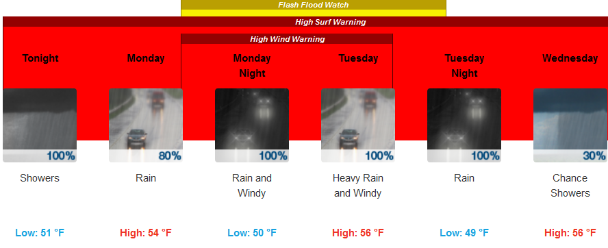
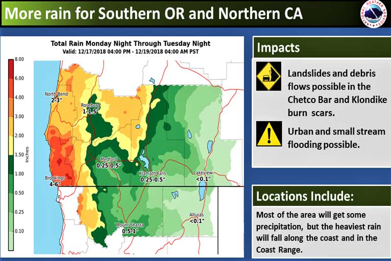
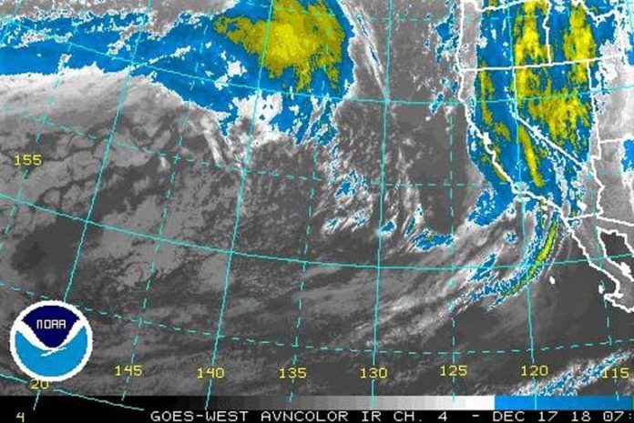
More rain is on the way Monday night through Tuesday night. A frontal system will move into the area Monday night, then slowly move through on Tuesday. This front is expected to be one of the wetter fronts so far this season,
Because of the large amount of rain, there is the potential for landslides and debris flows inside the Klondike and Chetco Bar burn scars. Please avoid this area if possible.
Brookings:

Medford:

The National Weather Service in Medford has issued a Flash Flood Watch for ONLY the Klondike and Chetco Bar burn areas in portions of Curry and western Josephine Counties in southwest Oregon from late Monday afternoon through Tuesday evening.
Flash floods, rock slides, and debris flows are possible due to heavy rainfall beginning late Monday afternoon and continuing through Tuesday evening. Peak rain rates could reach up to one half of an inch per hour, especially late Monday night and during the daylight hours Tuesday. Storm total rainfall of 3 to 6 inches is possible with locally higher amounts in favored areas in the Coast Range. Rain will subside Tuesday night.

A Flash Flood Watch means that conditions may develop that lead to flash flooding. Flash flooding is a VERY DANGEROUS SITUATION. You should monitor later forecasts and be prepared to take action should Flash Flood Warnings be issued. Landslides and debris flows are possible. People, structures and roads located below steep slopes, in canyons and near the mouths of canyons may be at serious risk from rapidly moving landslides.
Please Like, Share and Follow the …


