

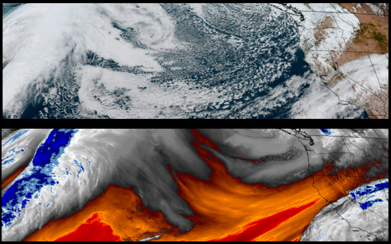
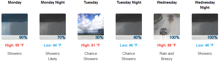
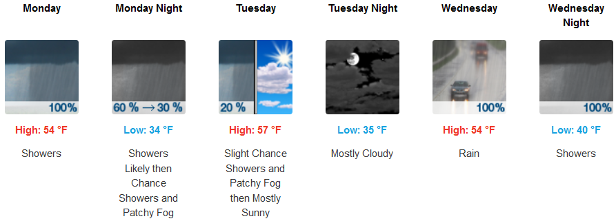
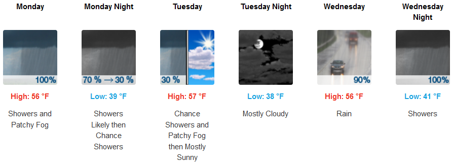
On shore flow from a deepening upper level trough off the northwest coast is forecast to continue bringing an unsettled colder air mass to the region with chances for increased precipitation across the southwest Oregon and northwest California after high winds and periods of heavy rain cycled through the area over the weekend.
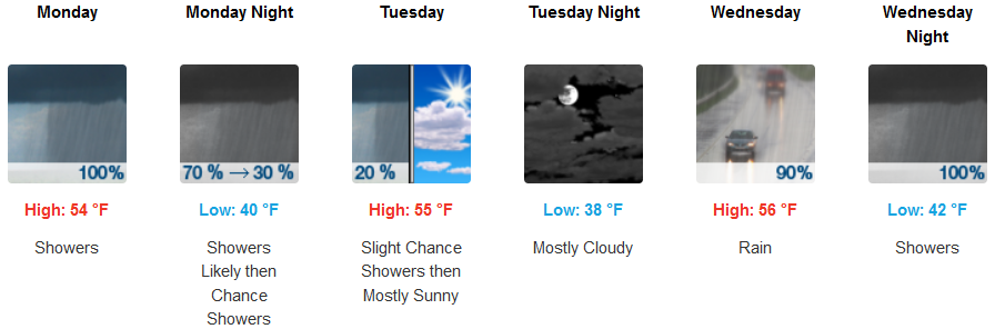
Inland areas are expected to continue to see cooler temperatures and precipitation with snow possible at the highest elevations as surface cold front pushes southeastward into mid week. High temperatures will be in the mid 50’s, as the work week continues with morning lows starting in the upper 30’s to the low 40’s.
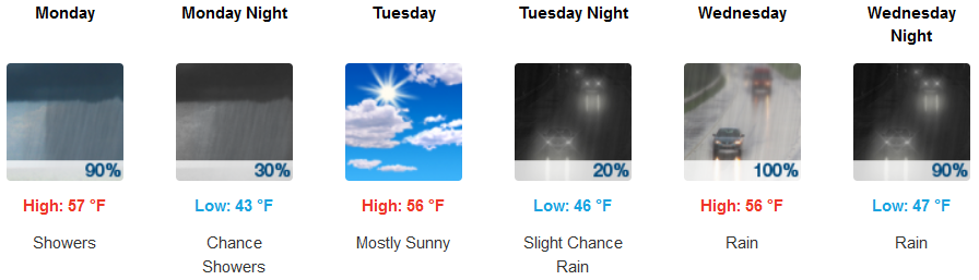
Along the coast, onshore flow off the ocean is expected to keep cooler, moist air pushing onshore with cooler temperatures and periods of precipitation into the midweek. Afternoon highs will be in the mid 60’s with early morning lows starting in the mid 40’s.
Brookings:
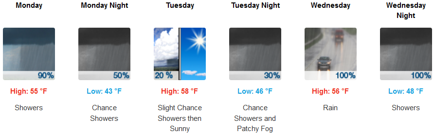
Crescent City:
Gold Beach:
Cave Junction:
Grants pass:
Medford: