

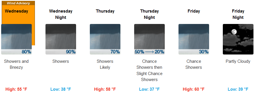
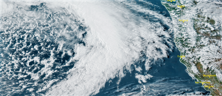
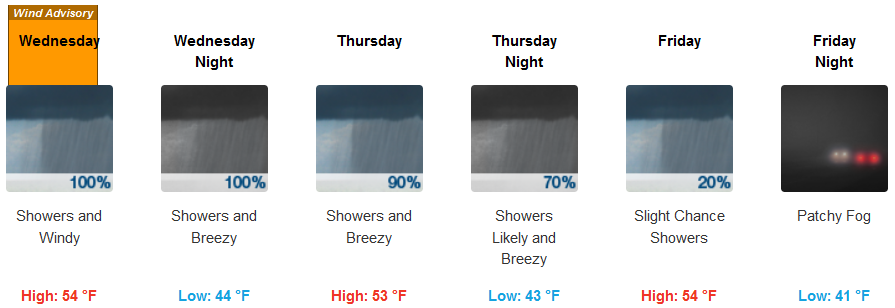
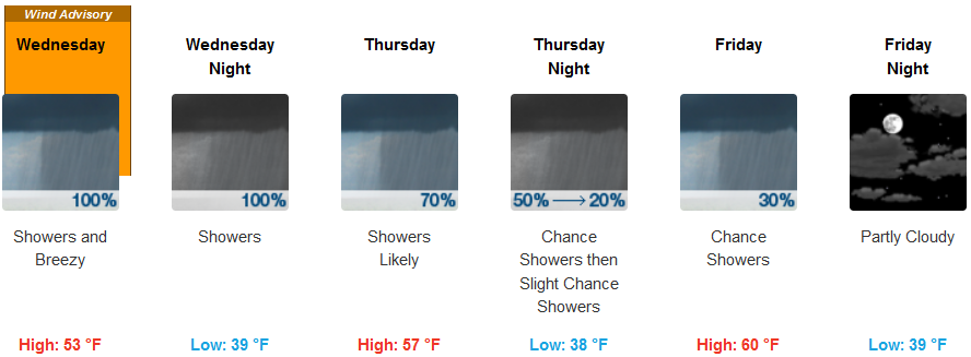
A strong upper level low will usher in a front Wednesday that will bring gusty winds up to 45 mph with thunderstorms, hail and possibly heavy rain for most areas in Southern Oregon and Northern California.
Strongest winds are expected Wednesday morning through Wednesday afternoon prompting Wind Advisories from the Nation Weather Service across the region.
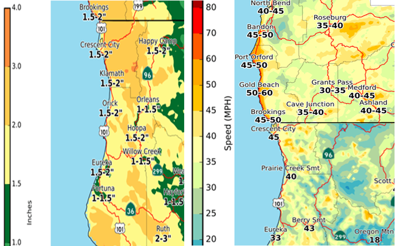
As the front pushes onshore, the possibility of hail storms will increase and continue after the leading edge passes with a colder unstable air mass to follow behind it producing localized areas of precipitation and thunderstorms into late Thursday, early Friday.
Brookings:
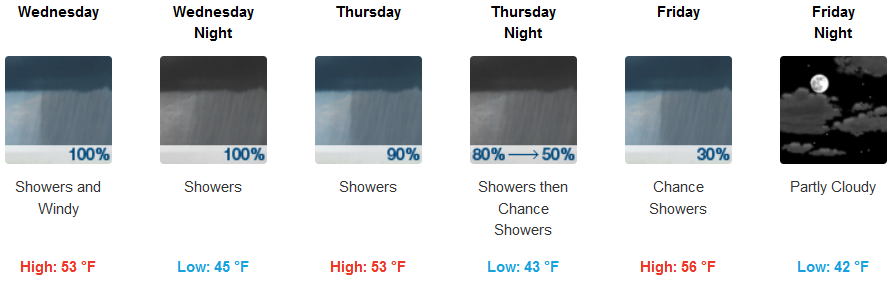
Crescent City:
Gold Beach:

Cave Junction:

Grants Pass:
Medford: