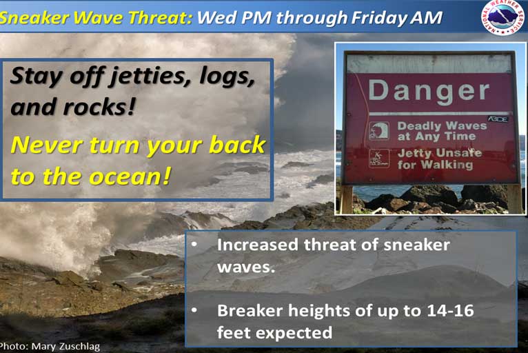
Sneaker waves are possible at the coast Wednesday afternoon through Friday morning. The highest risk for sneaker waves is Wednesday night through Thursday.
A Beach Hazards Statement has also been issued for threats such as rip currents … longshore currents … sneaker waves and other hazards create life-threatening conditions in the surf zone. Caution should be used when in or near the water.
Breaker heights of 14 to 16 feet are expected. Long period swell will create waves with larger run-up than usual. All areas along the coast will be affected, but the threat will be highest on west and northwest facing beaches.

Stay off jetties, logs, and rocks. Waves with higher run-ups can surprise beachgoers, knock them off their feet, and sweep them into the ocean. Large waves will also wash over jetties and rock outcroppings that normally stay dry. If you are swept into the ocean, you only have 10 minutes in 50-degree water before your legs, arms, and hands are unable to make any meaningful movements.
The threat will be highest on west and northwest facing beaches all along the Coos and Curry county coastline as well as northern California. The highest risk will be late Wednesday night through Thursday and into Friday morning.
Please Like, Share and Follow the …


