

A fast moving weather system passed over the region Wednesday with more wind and wet weather, and is forecast to be followed by yet another slightly warmer and wet weather system Thursday, continuing the wet weather pattern into the weekend.
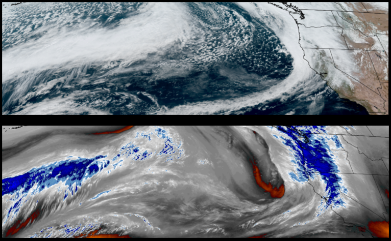
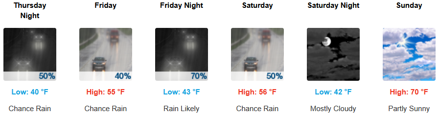
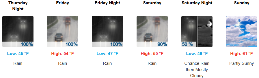
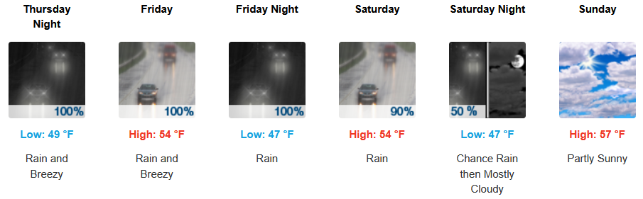
Rain from a series of weather systems moving into the area is forecast to continue for inland areas with snow at the highest passes and continuing into the weekend. Early morning lows are expected to be in the upper 30’s to low 40’s with highs in the low to mid 50’s.
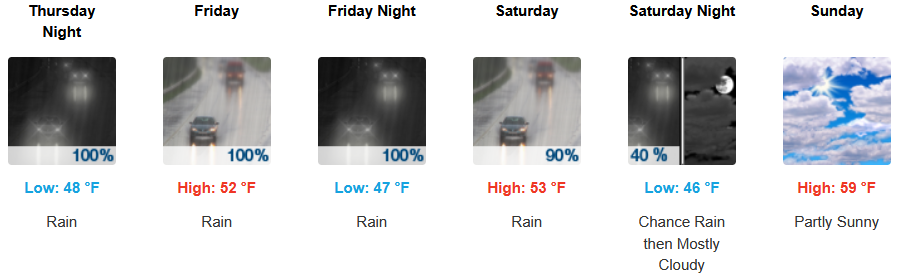
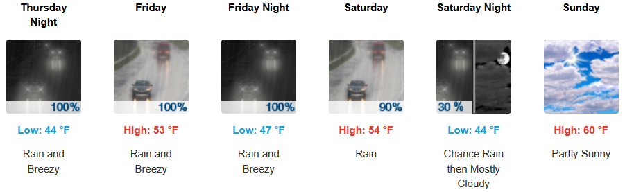
Along the coast, rain is expected to continue as another set low pressure system fronts continue to move onshore with rain continuing into the weekend. Temperatures are forecast to consistently be in the low 50’s for afternoon highs with morning lows cooling to the low to mid 40’s.
Brookings:
Crescent City:
Gold Beach:
Port Orford:
Cave Junction:

Grants Pass:

Medford: