


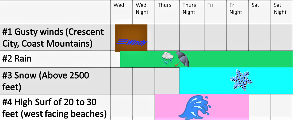
The National Weather Service has issued a High Surf Warning…which is in effect from 4 PM Wednesday to 7 AM PST Saturday.
A strong front will move through the coastal waters Wednesday with gale to storm force winds, followed by an extremely high and very steep westerly swell on Thursday when seas are expected to peak near 30 feet. Seas will then remain elevated through late this week. Southwest to west swell of 13 to 15 feet today and tonight. Increasing wind waves combined with west swell will produce seas of 20 to 24 feet Wednesday. Wednesday night into Thursday, west swell will build to a peak around 30 feet, then seas remain elevated through Friday night.
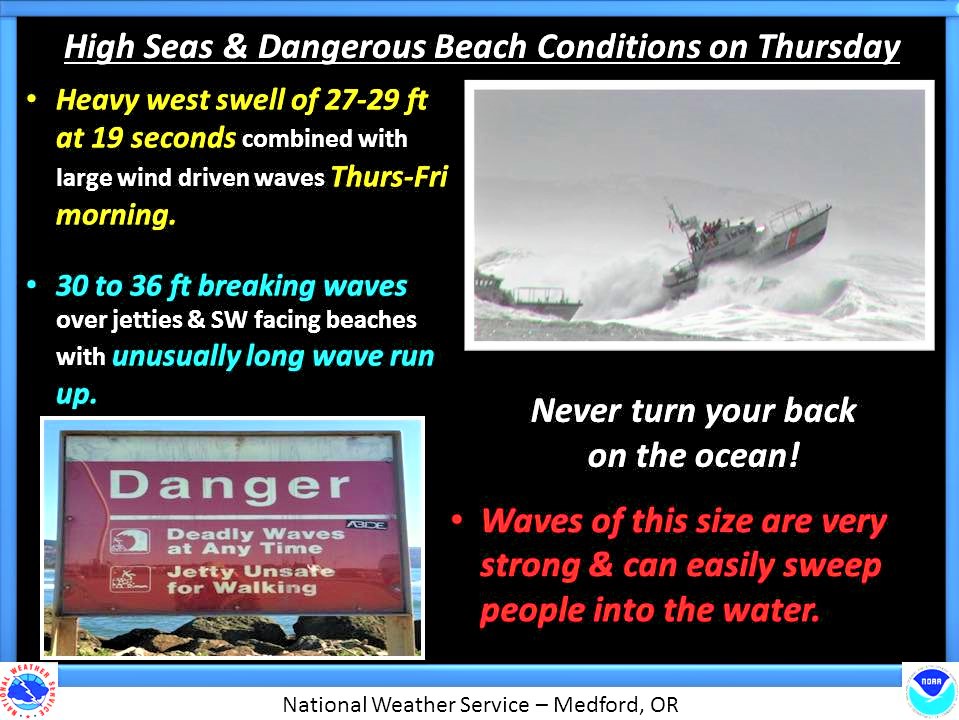
Waves will run up much higher on the beaches than normal. These waves will be powerful and can sweep people off jetties and other exposed rocks. They can also easily move large logs and other beach debris. Bar crossings and the surf zone will be especially dangerous due to strong currents and breaking waves.
A High Surf Warning indicates that dangerous, battering waves will pound the shoreline. This will result in life-threatening
conditions.
Stay off jetties and piers since they can be quickly inundated by the heavy surf.
Please Like, Share and Follow the …
![]()