

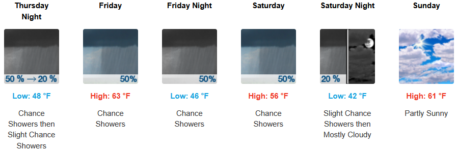
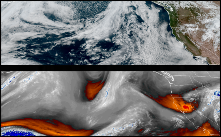
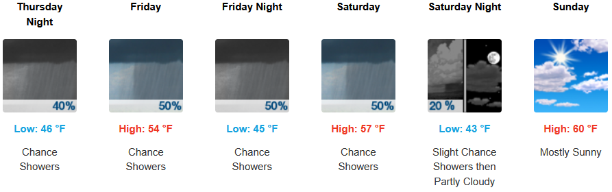
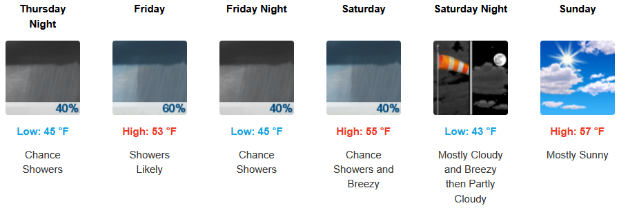
As the trough of high pressure that has consistently pushed weather systems to our north begins to move off to the east, unstable air will begin to move onshore bringing with it increasing cloudiness, slightly cooler temperatures and the possibility of showers as early as Thursday, and continuing into and through the weekend.
Inland areas are forecast to see increasing cloudiness Thursday with the chance of early afternoon showers and possible thunderstorms into the evening, with rain possible through Saturday. Early morning lows are expected to be in the low to mid 40’s, with highs likely reaching the mid to upper 60’s 70’s to close out the week.
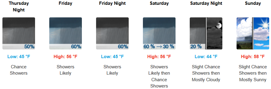
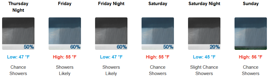
Increasing cloudiness will start Thursday on the coast, with wind gusts up to 20mph through Thursday with chances of precipitation as early as Thursday, continuing through Saturday. Afternoon highs are expected to be in the mid 50’s, and early morning lows in the mid 40’s.
Brookings:
Crescent City:
Gold Beach:
Port Orford:
Cave Junction:
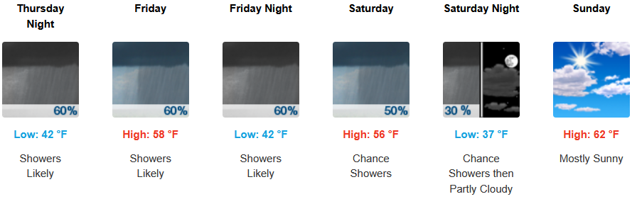
Grants Pass:
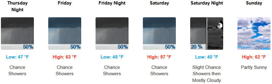
Medford: