

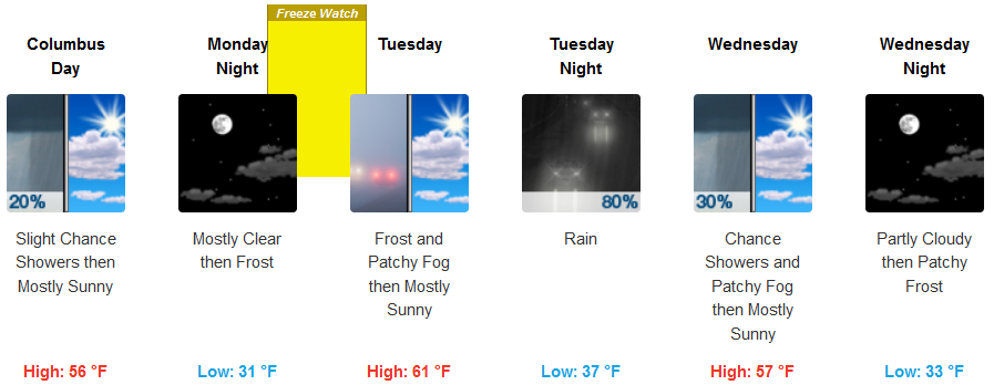
Record low temperatures are possible especially on Tuesday morning in the southern Oregon region with the next wave of Pacific moisture forecast to reach the Pacific Northwest Tuesday.
Slight chances of localized showers remain through Monday morning as unsettled weather circulates into the area from the north. Very low temperatures are forecast with frost warnings and advisories issued along northern Oregon coastal areas as well as interior elevations and valleys.
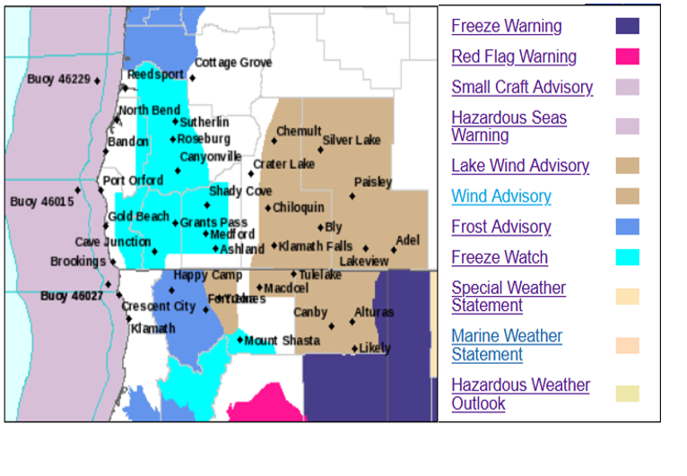
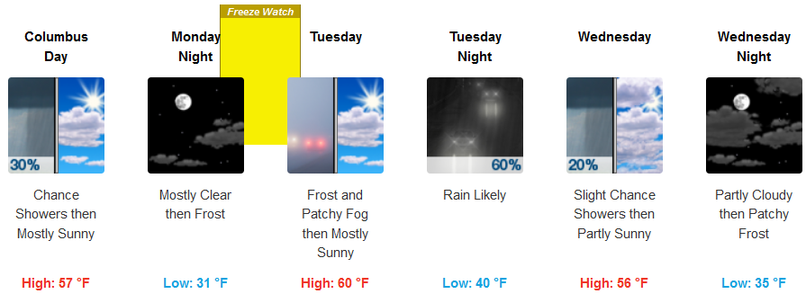
Inland, the National Weather Service has issued a Freeze Watch covering the Cave Junction, Grants Pass, and Medford areas for Monday night into Tuesday morning. Rain is likely Tuesday very late Tuesday night clearing Wednesday. Temperatures will be below average with high temperatures in the low 60’s and low temperatures below freezing Monday night into Tuesday morning leveling at the upper 40’s.
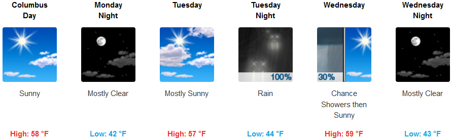
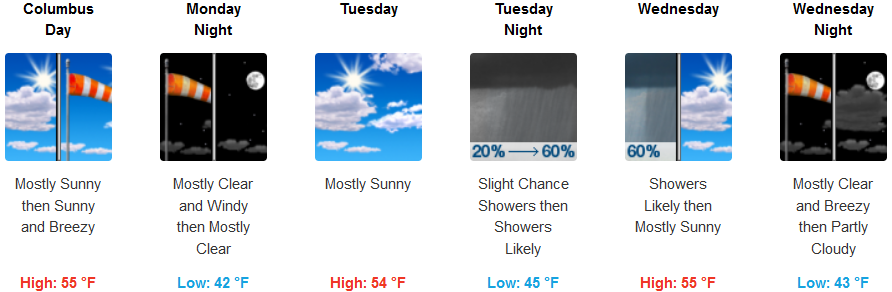
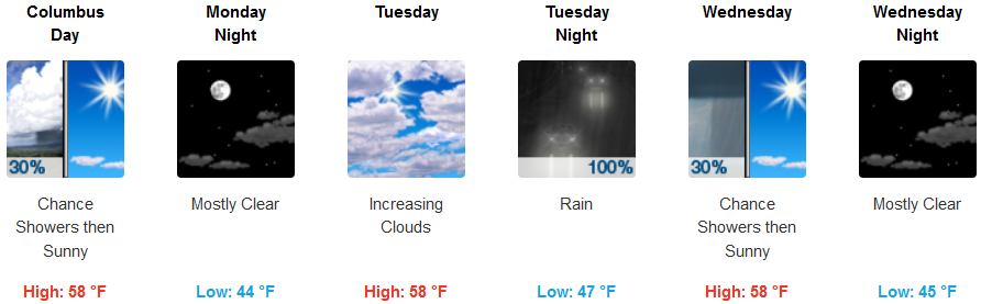
Coastal areas are not forecast to experience the brunt of the cold air and have not received frost advisories or freeze warnings, however, rain is forecast beginning Tuesday night, clearing Wednesday. High temperatures will reach the upper 50’s with lows in the low 40’s.
Brookings:
Crescent City:
Gold Beach:
Cave Junction:
Grants Pass:
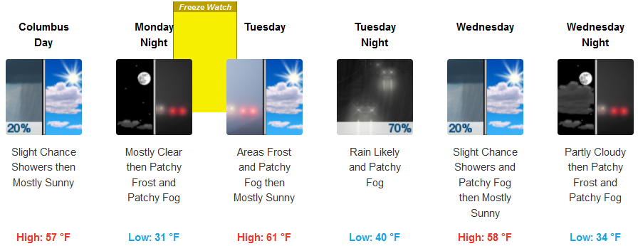
Medford: