

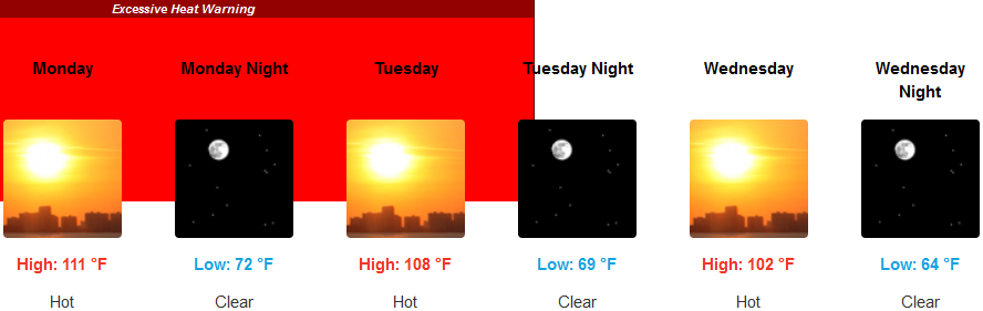
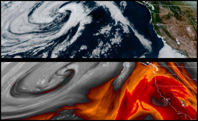
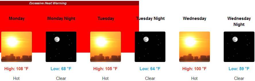
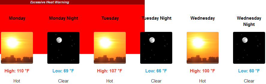
Dangerously high temperatures have persisted across much of the west under a strong dome of high pressure that is expected to keep skies clear with extreme high temperatures across the Northwest as daily record temperatures continue to be tied or broken into the work week.
Inland are forecast to see clear skies and very high triple digit temperatures with very little if any relief during the evening and early morning and warming quickly by mid to late morning. Clear skies will continue with morning lows only getting to the upper 60’s to low 70’s before afternoon highs reach up to 110 degrees in some areas.
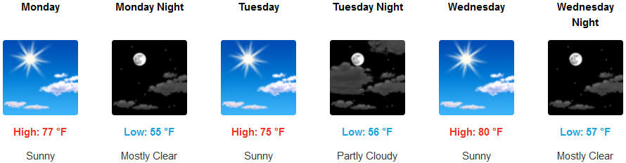
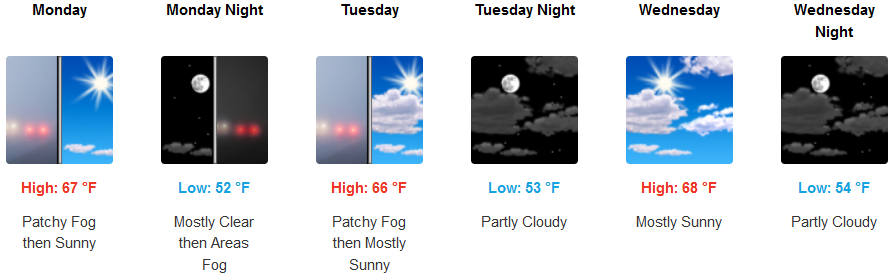
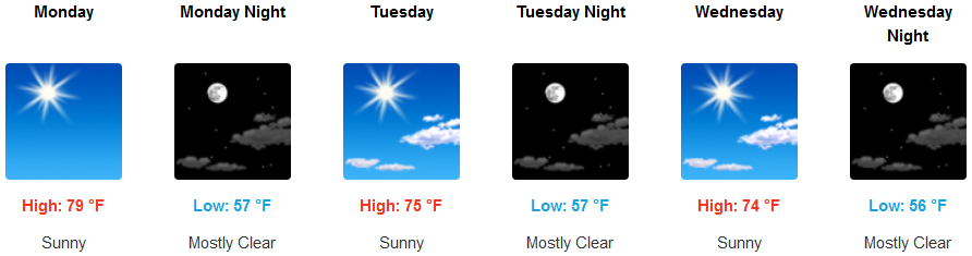
Along the coast mostly clear skies with the possibility of a very early marine layer are expected to continue with very little to no wind into the work week with the warmest temperatures mid-week. Morning lows are expected to be in the mid to upper 50’s with afternoon highs reaching the low 80’s in some areas.
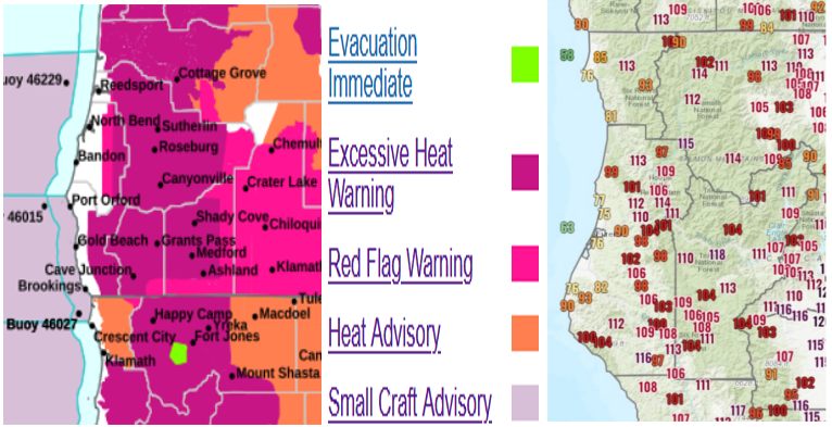
Brookings:
Crescent City:
Gold Beach:
Cave Junction:
Grants Pass:
Medford: