


A high surf advisory is in effect until 4:00 am Saturday. Large swells will create breaking waves up to 25 feet. Sneaker waves can cause sudden rushes of water over areas not previously washed by waves. Hazardous surf will cause waves to run up much higher on the beaches than normal.
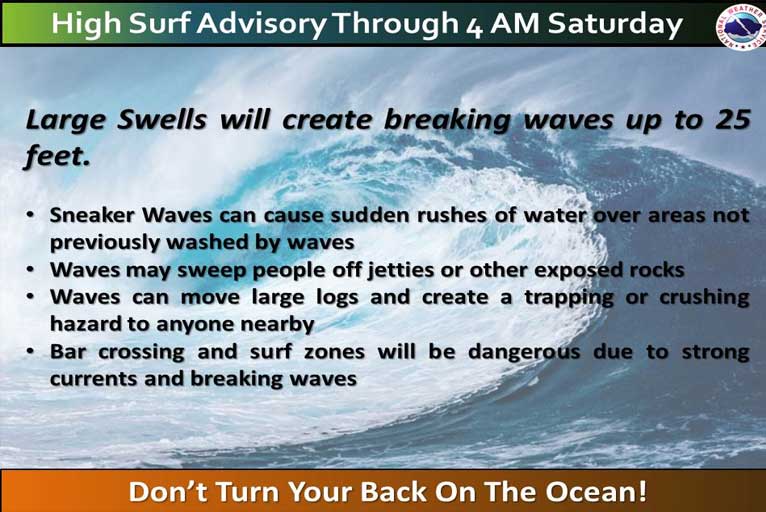
These powerful waves can sweep people off jetties and other exposed rocks. They can also easily move large logs and other beach debris and create a trapping or crushing hazard to anyone nearby. Bar crossings and the surf zone will be dangerous due to strong currents and breaking waves.
Brookings:
Medford:
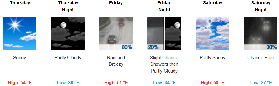
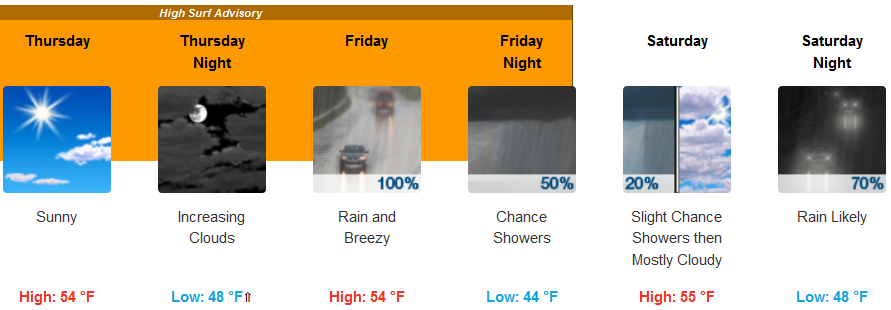
Across the Northwest, a cold front will approach but stall, allowing for a prolonged period of onshore flow into northwest regions. A cold front will impact the area Friday as it moves eastward across the region. Rain and gusty winds will begin early Friday morning as the system approaches.

Snow is expected during the day on Friday with some snow accumulation possible as low as 4,500 feet Friday afternoon and evening. Another system is forecast to move through the region Sunday and into Sunday night, bringing additional rain, wind, and mountain snow.
Please Like, Share and Follow the …
![]()