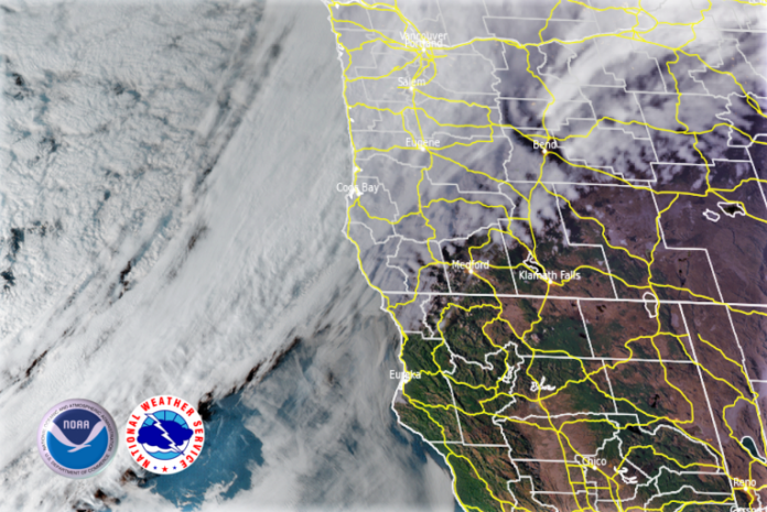
With the ridge of high pressure now out of the area, the forecasted rain moved into the area late Thursday and will usher in a strong upper-level trough and an associated cold front reaches the West Coast accompanied by very cool temperatures in the next few days.
High temperatures on Friday across Oregon and California will generally be in the 50s and 60s, or about 10 to 15 degrees below average as colder weather will continue to move in for Saturday behind the cold front. Rain early on Friday will begin to change to a rain/snow mix and eventually snow for mountain and interior locations.
Steep, hazardous seas and high surf of up to 23 feet are forecast to build across the coastal waters late this week particularly west to northwest facing beaches in northern California and southern Oregon beaches. A High Surf Advisory is in effect for Friday afternoon and evening, use extra caution near the surf zone as these large waves will be capable of sweeping people into the cold and turbulent ocean.
Brookings:
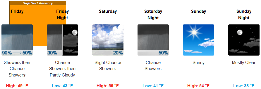
Crescent City:
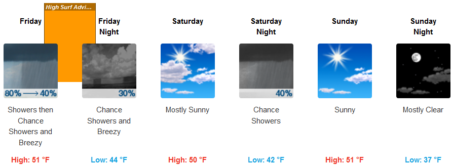
Gold Beach:
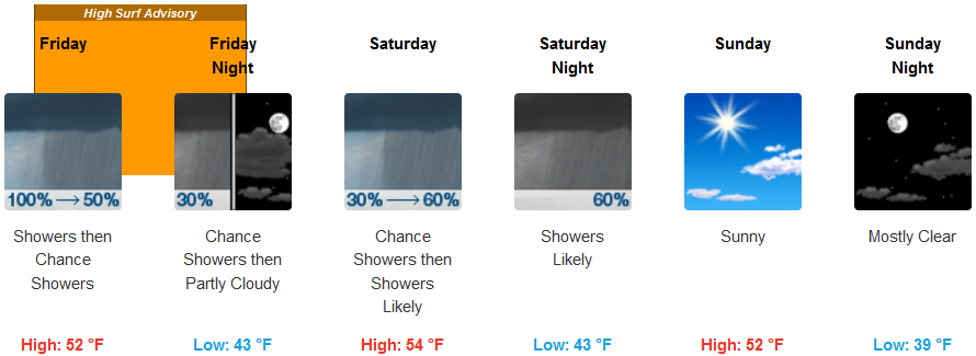
Cave Junction:

Grants Pass:

Medford:


