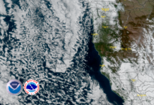
Friday, September 8th, was another day of moisture and slow advancement resulting in minimal fire behavior due to rainfall, marine layer, and high relative humidity. With no Infra-red flyover on Friday, officials report that an estimated 400 acres were added to the fire perimeter, making the total acres burned 177,693 acres and the fire remains at 5% contained as of midnight, Friday, September 8th.
After the past two days of cooler wetter weather, the next 24 hours are expected to bring a drying trend, with low to moderate fire behavior such as surface spread, backing and flanking. Where wetting rain was not received, smoldering and creeping with little perimeter movement on the west side is expected with some torching. The East side will see some surface spread in heavier fuel concentrations where recoveries are reduced. Overall lower fire spread in lower elevations, while higher elevations may see a little increase in activity.
Late Saturday and into Sunday officials expect to see drying winds with surface spread, backing, flanking where wetting rain was not received. Group torching and spotting possible when conditions have dried out.
Working with the weather on their side that reduced the intensity of the fire, crews on the western perimeter were able to move in closer to the fire’s edge and build more direct containment lines.
On the southwest edge, operations continued to hold and improve firelines while at the same time deploying more hose lines to be used in securing those lines. Firefighters on the north side in Josephine County were able to connect and tie into lines to the east while scouting and constructing firelines to the south into California continued.
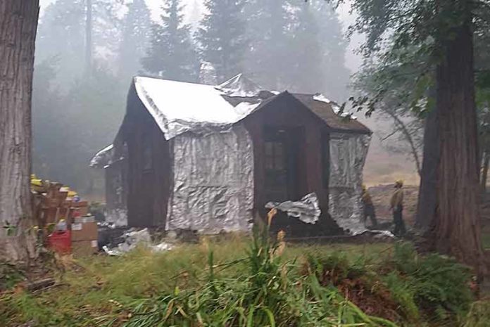
North of the fire at the confluence of the Illinois and Rogue rivers, structure assessment and preparation continues in the community of Agnes.
The recent rain and high humidity levels delayed implementing strategic back fire burning operations that would consume fuel between the main fire and containment lines used to add depth and strengthen existing lines.
Larger vegetation remains dry though, and residents should be aware that as temperatures rise and humidity levels drop again over the next 72 hours, fire activity will pick up. Areas, where little activity occurred yesterday, may hide burning roots and when winds increase and humidity levels drop the possibility that the fire will spread to nearby receptive fine fuels like grasses, leaves and small twigs, still exists.
As humidity levels begin to drop and temperatures begin to rise, vegetation will dry out over the next 24 to 48 hours. Hazards faced by firefighters in the current conditions include access to wet areas with steep slopes with dirt roads and trees. These areas weakened by fire, are more susceptible to falling as wet soils loosen their hold on root systems.
Today strengthening of containment lines combined with opportunities to move in closer to the fire perimeter will be utilized in attempts to take full advantage of the moderate weather and reduce potential impacts to nearby private lands. Firefighters will continue to remove brush and vegetation along containment and contingency lines while ensuring that hoselays are in place and functioning properly. Ongoing efforts include patrols for spot fires, extinguishing areas of heat within spot fires. Fireline construction and, where containment lines have been secured by mop-up, fireline repair work and re-contouring lines will be made in efforts to mitigate water runoff).
Aircraft operations have been limited due to weather and smoke. If helicopters can safely fly, reconnaissance of the fire’s position and assessing protection needs will be completed. Air resources remain poised to respond as conditions change, and as visibility and weather allow, aircraft will support firefighters.
Curry County Sheriff and Josephine County officials will continue to monitor evacuation levels while the Oregon State Fire Marshal Task Force continues structure evaluation and preparation.
The Chetco Bar Incident Management Team, and Curry County Sheriff are reducing some Level 3 Evacuation areas to Level 2 Evacuation’s within Curry County. Only residents and land owners are allowed to enter the previous Level 3 Evacuation Areas.
These Areas include:
• Pistol River Road
• Carpenterville Road
• North Bank Chetco River Road to the established fire perimeter
• Gardner Ridge Road to the established fire perimeter
• South Bank Chetco River Road
Residents must pick up the re-entry materials from 11am to 4 pm at Ray’s Market 906 Chetco Ave in Brookings, Oregon. All residents that live in these geographic areas are asked to present their picture ID to Curry County Sheriff’s Office Staff to receive re-entry materials. Residents and land owners will need to present the materials received from the Sheriff’s Office at their established re-entry point.
Residents should remain prepared to evacuate in a moment’s notice in the event the evacuation levels change and residents should not return any large animal’s home at this time. Fire and emergency resources will continue to be active in the areas and road systems. Please drive slowly and be aware of additional traffic in the Level 2 Evacuation area.
The Tolowa Dee-ni’ Nation is now operating a shelter at The Xaa-wan’-k’wvt Village & Resort (old Ship Ashore) RV Park located at 12370 Highway 101 North in Smith River.
Residents are encouraged to monitor the interactive evacuation map for changes: http://arcg.is/2vWQN2N


