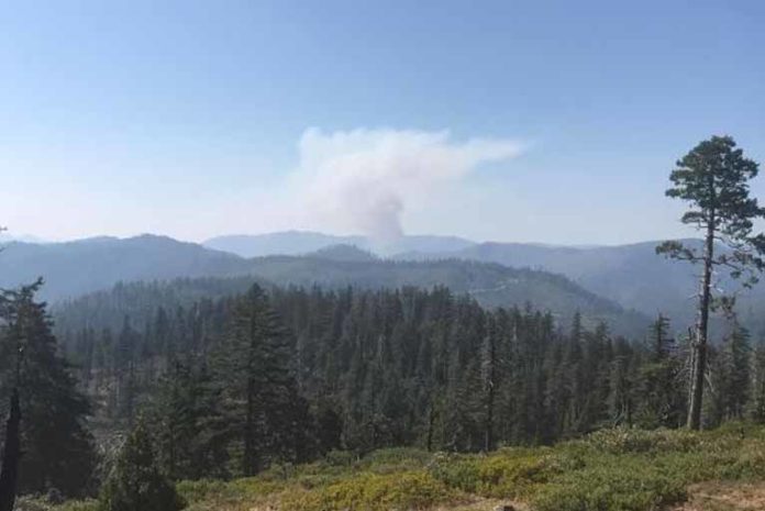
On Monday, September 11th, 2017, the most significant fire activity on the Chetco Bar Fire was on the southern perimeter. Retardant drops have significantly slowed the fire’s spread. The fire now stands at 182,340 acres and containment has increased to 8%.
Monday, saw the warmest and driest conditions over the fire area in the past week along with gusty northeast winds and smoke. A gradual trend of cooler temperatures and higher humidity levels begins on Tuesday and continues into Thursday. Winds over the fire will gradually decrease on Tuesday and become northwest on Wednesday. Wind speeds will increase from the northwest on Thursday as a dry cold front moves through the area. No precipitation is expected for the remainder of the week.
There was a significant increase in smoke settling in the Illinois River Valley on Monday afternoon. Observers noted that the majority of this smoke was being blown in from other fires to the east of the Valley and not produced by the Chetco Bar Fire.
In the Chetco East Zone Fire area, a new fire was reported near West Fork Indigo Creek, approximately 10 miles north of the main fire. Fire 784, the “Indigo Fire,” is currently 100 acres and is burning in brush and light timber within the Biscuit Fire burn scar. Smoke jumpers, rappellers, and retardant were unable to be used due to steep terrain. Helicopters made water drops on this fire for approximately 4 hours until dark.
Monday, fire crews scouted locations for fireline construction on the ridge near Buckskin Peak and continued linking and extending dozer line sections as a containment line east of the fire.
Temperatures today will be down 4-8 degrees with a high of 88 degrees on ridges. The valleys will be hotter. Relative humidity is predicted to increase 6-8%, but dryness last night means today’s burning period will be longer. The minimum relative humidity is forecast at 24%. Winds are forecast out of the north-northeast at 6-12 mph. These conditions could generate 4-foot flame lengths with possible spotting to ¼ mile. Thunderstorms are forecast east and south of the Chetco Bar Fire area. Initial attack crews will be available to respond to new starts and spot fires.
1,538 firefighters will be attempting to secure fire spread to the north in the Pistol Creek drainage area by tying into the Pistol Creek drainage through direct and indirect attack operations. They will be using trail and line construction along the fire edge utilizing mechanical equipment, and aerial support as needed. Crews will continue to monitor and patrol the back edge of the fire and spot fires maintaining vital structure protection.
Officials plan to utilize aircraft for reconnaissance and to check fire spread when smoke and fog conditions allow.
Today, 4 hand crews and 2 dozers will open roads adjacent to the Indigo Fire and identify containment lines to surround it. On the rocky ridge between Parker and Josephine Creeks, handline construction will continue to tie together dozer lines. A spike camp is being set up for firefighters to stay in this area. A spike camp allows firefighters to get adequate rest, meals, and supplies without having to travel long distances to the main fire camp. Handline work will also continue around Tennessee Mountain. Dozers continue to push fireline construction farther north into the Chrome Ridge and Silver Creek areas.
The Chetco East Zone Fire management team has activated a new public fire information line (541-597-8525) dedicated to sharing information about activities on the Josephine County side of the fire.
As of this update, all previous evacuation levels remain unchanged and intact. This includes a Level 3 evacuation order for all residents on Illinois River Road within the US Forest Service Boundaries and the Oak Flat Community.
The Chetco Bar Incident Management Team, and Curry County Sheriff have reduced some Level 3 Evacuation areas to Level 2 Evacuation’s within Curry County. Only residents and land owners are allowed to enter the previous Level 3 Evacuation Areas.
These Areas include:
• Pistol River Road
• Carpenterville Road
• North Bank Chetco River Road to the established fire perimeter
• Gardner Ridge Road to the established fire perimeter
• South Bank Chetco River Road
Residents must pick up the re-entry materials from 11 am to 4 pm at Ray’s Market 906 Chetco Ave in Brookings, Oregon. All residents that live in these geographic areas are asked to present their picture ID to Curry County Sheriff’s Office Staff to receive re-entry materials. Residents and land owners will need to present the materials received from the Sheriff’s Office at their established re-entry point.
Residents should remain prepared to evacuate at a moment’s notice in the event the evacuation levels change and residents should not return any large animal’s home at this time. Fire and emergency resources will continue to be active in the areas and road systems. Please drive slowly and be aware of additional traffic in the Level 2 Evacuation area.
The Tolowa Dee-ni’ Nation is now operating a shelter at The Xaa-wan’-k’wvt Village & Resort (old Ship Ashore) RV Park located at 12370 Highway 101 North in Smith River.
Residents are encouraged to monitor the interactive evacuation map for changes: http://arcg.is/2vWQN2N


