

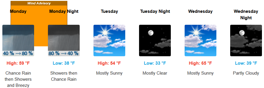
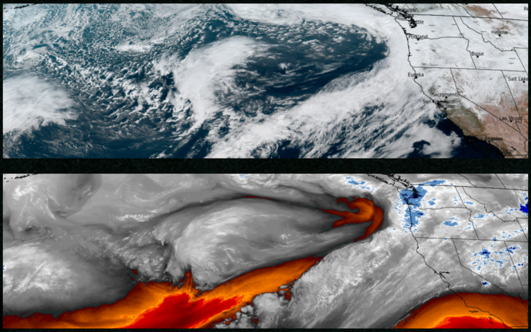
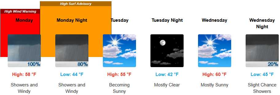
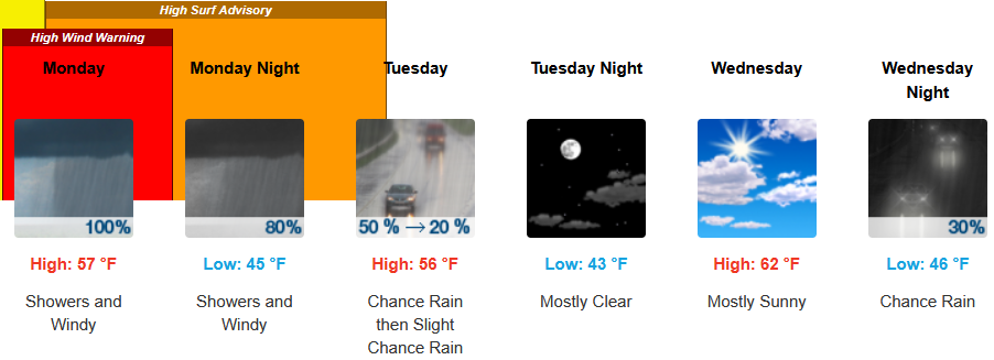
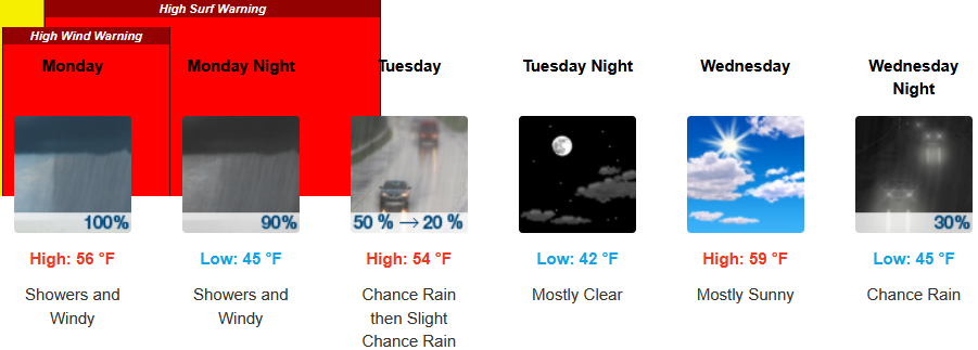
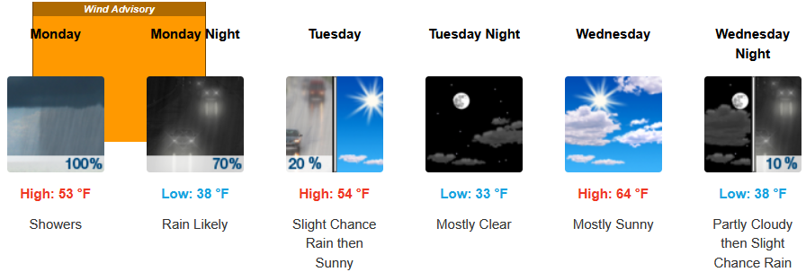
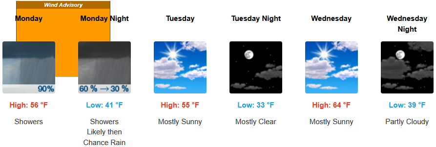
After the weekend’s round of precipitation moves to the east, another round of rain, gusty winds and possible thunderstorms is forecast to move into the region continuing through Monday and into Tuesday.
Inland areas can expect rain through Monday and early Tuesday before the recent system moves east and partly cloudy skies are left through midweek. Low temperatures are expected to range from the low to mid 30’ss, with highs only getting into the mid to upper 50’s.
Coastal areas are forecast to wake up to rain Monday morning continuing through Tuesday morning before unsettled air ushers in partly cloudy skies into midweek. Temperatures are forecast to be in the mid to upper 50’s for afternoon highs with morning lows cooling to the low to mid 40’s through the weekend.
Brookings:
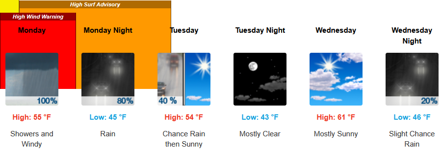
Crescent City:
Gold Beach:
Port Orford:
Cave Junction:
Grants Pass:
Medford: