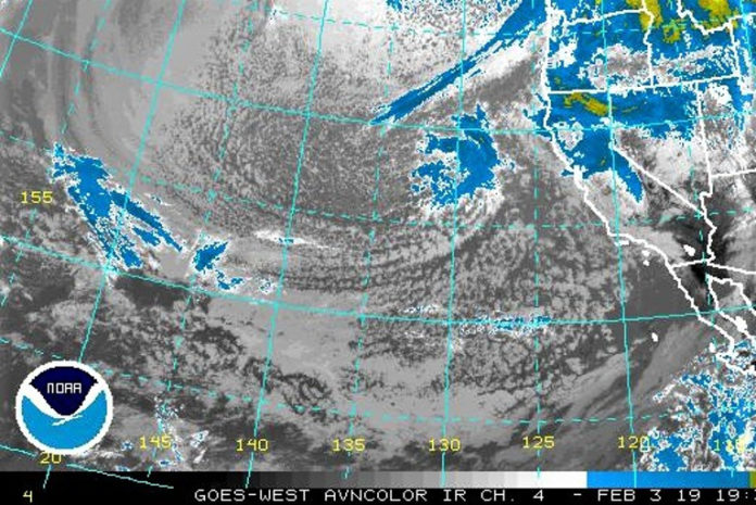
A complex series of storm systems will bring a wide range of threats to the region through early Tuesday, including rain showers, gusty winds, low elevation snow, and small hail. Please use caution if planning to travel over the next few days, and make sure to monitor road conditions. This forecast includes a large and diverse area, and conditions will vary widely depending on your specific location.
Sunday afternoon’s visible satellite image shows some very interesting and/or unusual features. The arctic front has been approaching the coast and moved onshore over tonight. This will bring widespread snow to our area as snow levels crash to at most 500 feet and possibly all the way to sea level.
Extremely cold air, with temperatures well below zero, is flowing from B.C. out over the much warmer waters of the Pacific and producing bands of ocean-effect snow.
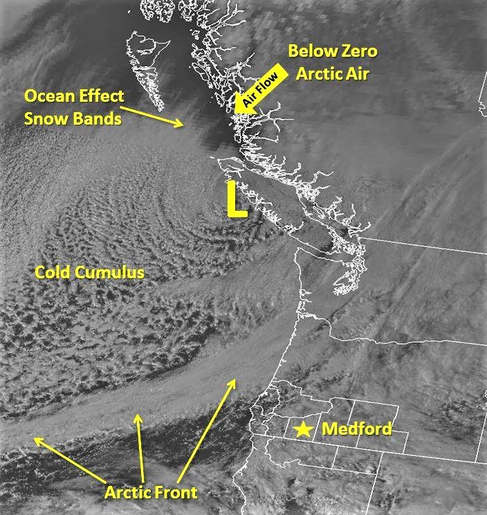
The cold air is modified as it moves over the warmer waters toward us, but it’s still cold enough to produce a lot of convection and showers behind the front as seen by the cumulus field behind the Arctic Front. In fact, temperatures along the Washington coast are in the 30s with snow falling at sea level. Waldport reported snow at sea level at about midnight last night.
Brookings:
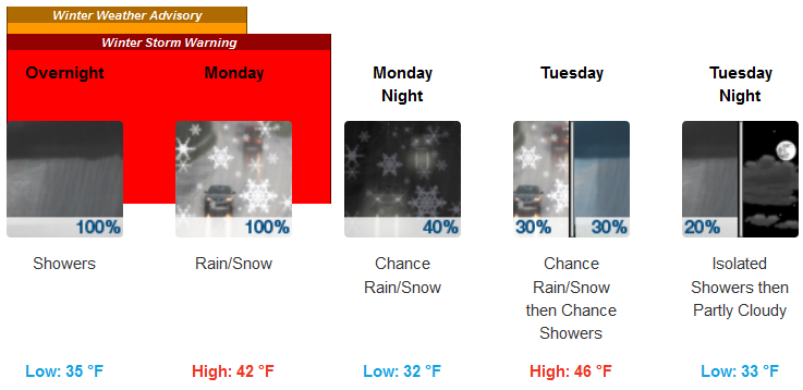 Medford:
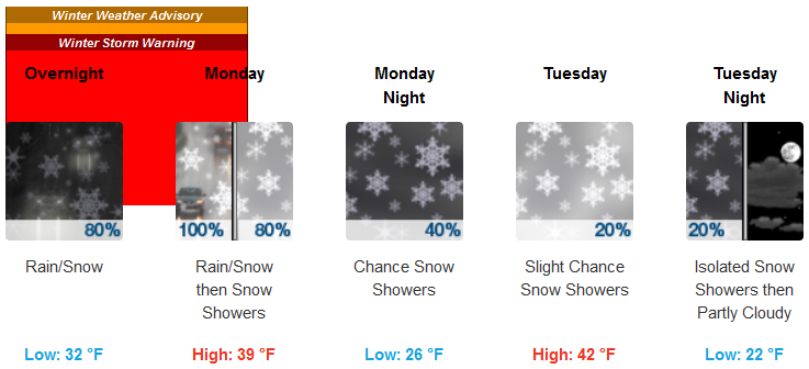 Expect rain changing to snow along the front as it moves inland tonight and tomorrow morning. Behind the front, very cold air moves in, and considerable showers (mostly in the form of snow) are expected later tomorrow.
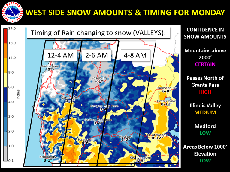
Heavy snow is certain above 2000 feet, and confidence is high that areas such as the Illinois Valley and the passes along I-5 north of Grants Pass will see significant impacts from snow. Confidence in accumulating snow is lower in locations such as Medford and Grants Pass due to the timing.
Cold air will be arriving with the front, and it is uncertain how long precipitation will last once it becomes cold enough for snow in these areas. At this time, we think we will see at least SOME snow in most locations above 500 feet.
Please Like, Share and Follow the …


