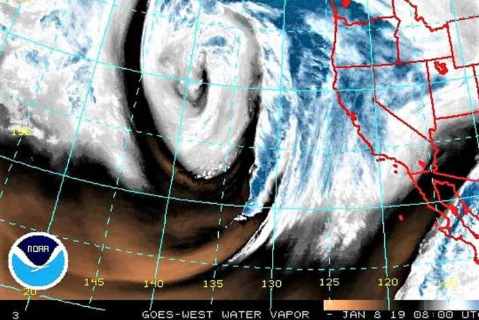
A strong weather system centered offshore is expected to bring another round of widespread moderate to heavy rain to southwest Oregon and northern California through Wednesday evening. The heaviest rain is expected Tuesday afternoon through Wednesday afternoon with locally strong southerly winds across mountain ridges and coastal headlands.
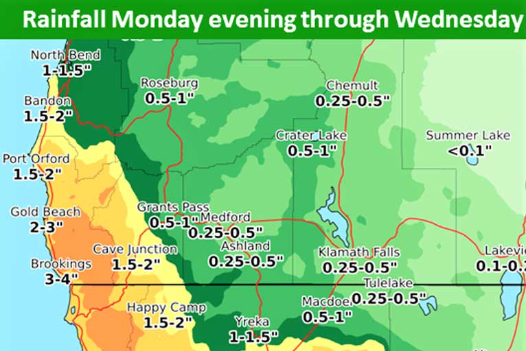
Total rainfall is not expected to be particularly impressive over the 2-day period, but periods of moderate to heavy rainfall are anticipated. Some of the heaviest rain will push through with a cold front late Tuesday afternoon & evening. Additionally, showers continuing into Wednesday will contain heavy downpours.
Brookings:
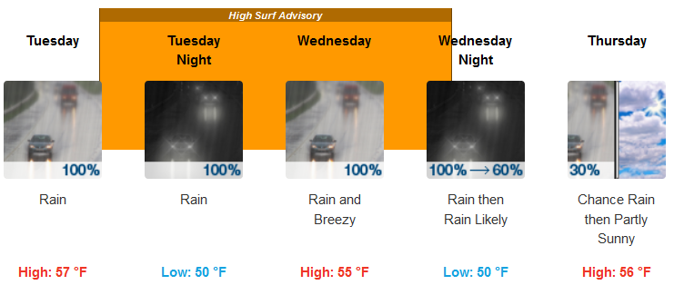
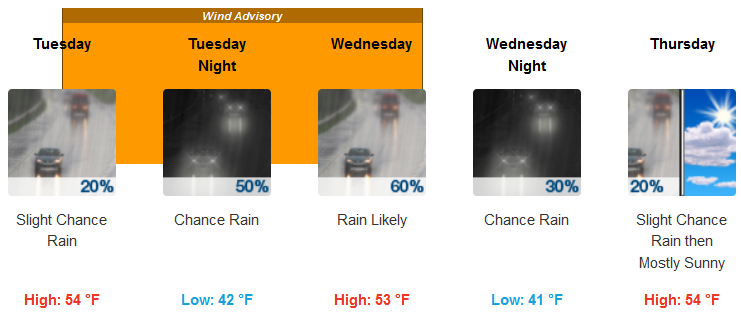
Medford:
The combination of heavy rain and snowmelt may cause flooding of small streams, creeks, and urban areas. Rapid rises are expected on some of the main stem rivers, including the Chetco, Scott and Klamath rivers, but flooding is not expected in these areas at this time. Strong winds are also expected in the Shasta Valley and in the southern Rogue Valley as well as over higher terrain east of the Cascades.
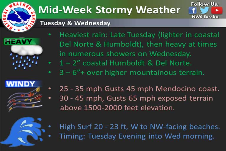
In addition to the wind & rain, a large swell will impact the coast leading to surf between 20 and 23 feet Tuesday evening through Wednesday morning. Beachgoers are advised to be very cautious and stay far back from the surf.
The next storm system creates wind-driven waves with large southwest swell to bring elevated surf and 22 to 25-foot breakers to the southern Oregon Coast Tuesday evening and all day Wednesday.
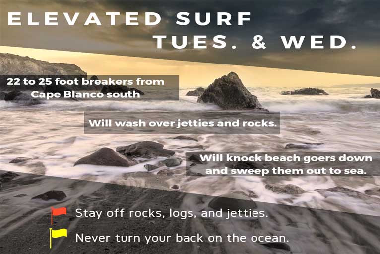
Beaches from Cape Blanco southward will be the most likely to see the large breakers. If you must go to the beach, stay off rocks, logs, and jetties. Never turn your back on the ocean.
Please Like, Share and Follow the …


