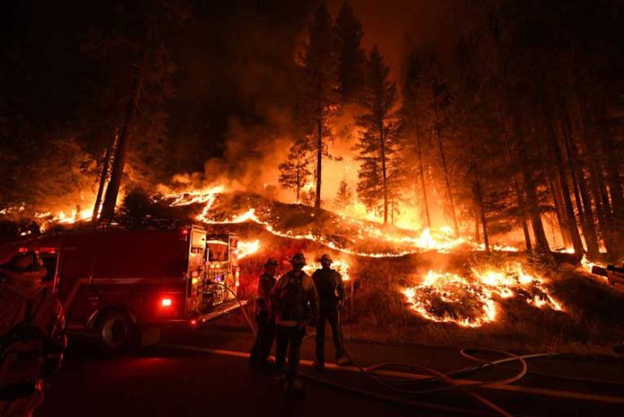
The now 133,950 acre Carr Fire burning in both Shasta and Trinity Counties added over 30,000 acres in the last 72 hours. The death toll still remains at 6 persons including 2 firefighters.
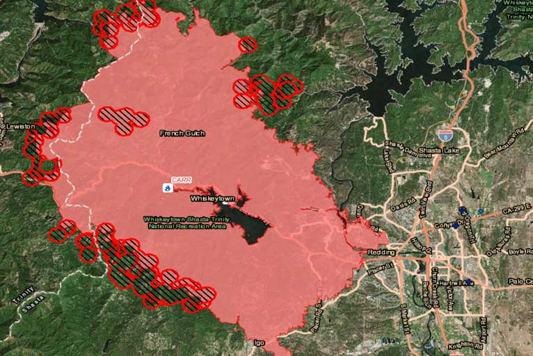
Tragically, 1070 residences, 21 commercial structures,and 492 outbuildings have been destroyed. 188 residences, 23 commercial structures, and 60 outbuildings have suffered different levels of damage and 1,358 Structures remain threatened.
Simulation of the Carr Fire using CALFIRE’s “sand” sim table
Lower humidity, increased winds, and an unstable atmosphere have increased fire activity. Firefighters continue to mitigate potential spot fires across control lines.
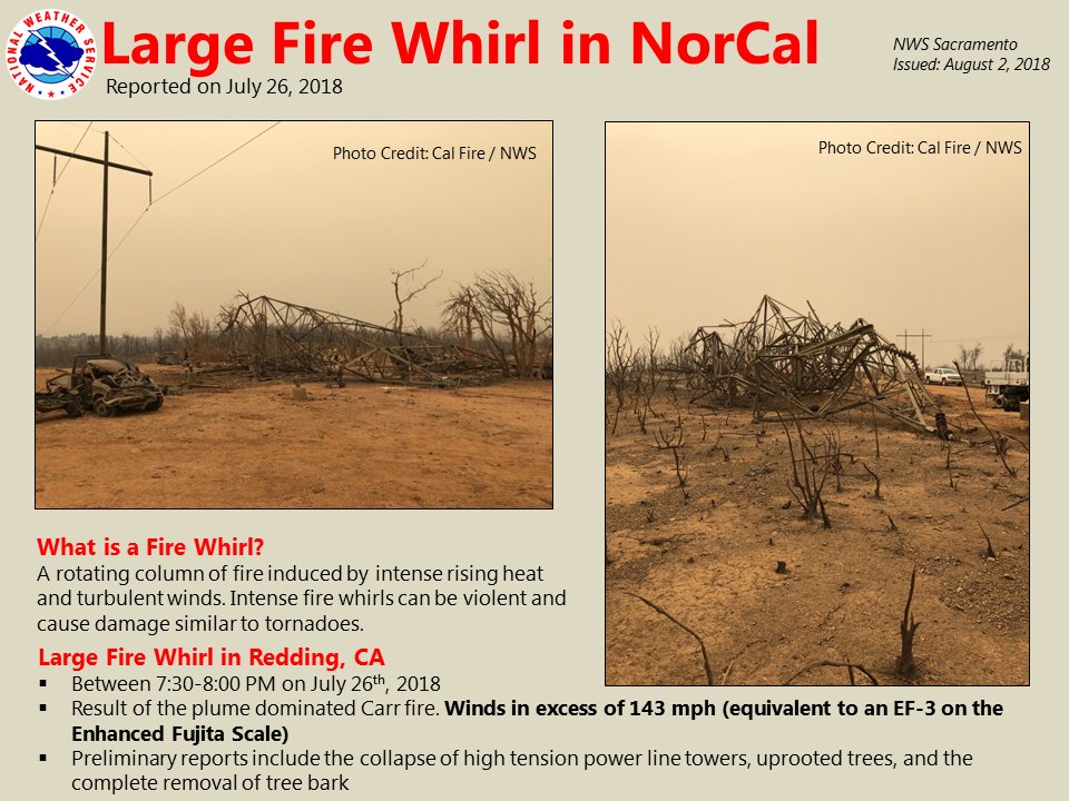
The National Weather Service and CAL_FIRE Serious Accident Review Team (SART) are conducting a storm damage survey regarding the large fire whirl that occurred Thursday evening in Redding. Preliminary indicators placed max wind speeds achieved by the fire whirl in excess of 143 mph.
Red Flag Warning remains in effect tonight through Saturday at 9 p.m. Repopulation of residents in the areas affected by evacuations will continue as conditions permit.
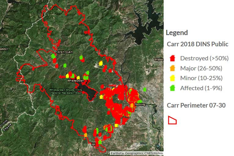
This Carr Fire Structure Map link (above) is interactive, and is continuously updated. Individuals can enter addresses and possibly learn about the condition of individual structures.
The Mendocino Complex:
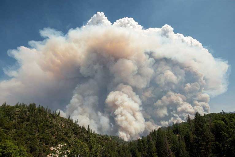
The 157,450 acre Mendocino Complex Fire raging in Mendocino County consists of the 115,250 acre Ranch Fire north of Clear Lake and the 42,200 River Fire southwest of Clear Lake. Unconfirmed reports are stating that the two fires have merged west of Clear Lake.
According to fire Officials from Cal Fire, both fires burned actively Thursday night and Friday morning, with the Ranch Fire moving rapidly eastward. Wind, heat, and low humidity have combined to challenge firefighting efforts.
The Ranch Fire, burning near Highway 20, Old Lake County Highway, and Blue Lake, 8 miles northeast of Ukiah. The River Fire was burning at Old River Road, 6 miles north of Hopland. Both fires had cumulatively destroyed 88 structures and damaged 19 as of Friday morning.
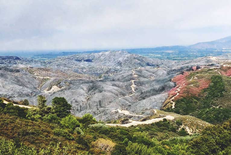
Large areas of evacuations were in effect Friday for communities in Mendocino County and Lake County. The latest update added areas in the community of Potter Valley area east of eastside Potter Valley Road and Eel River Road, south of the Eel River, west of the Mendocino Lake County line, and north of Mid Mountain Road.
Please Like, Share and Follow the …


