

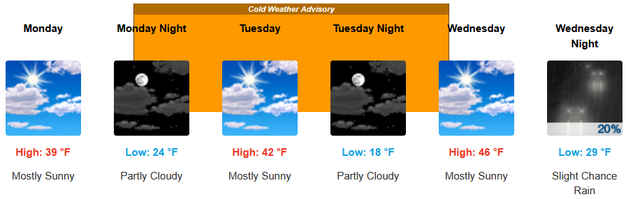
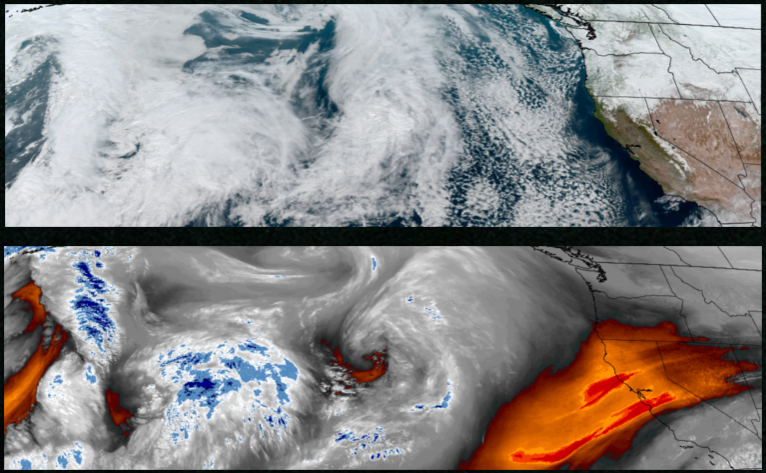
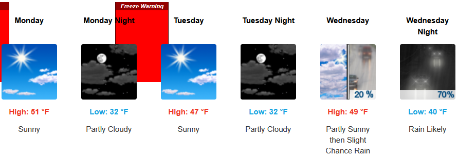
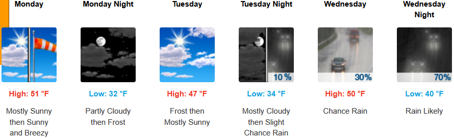
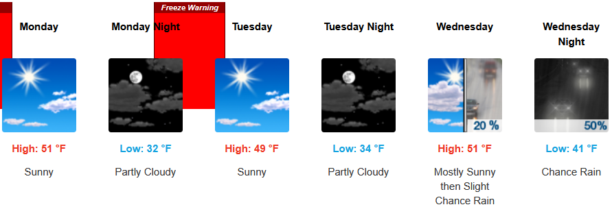
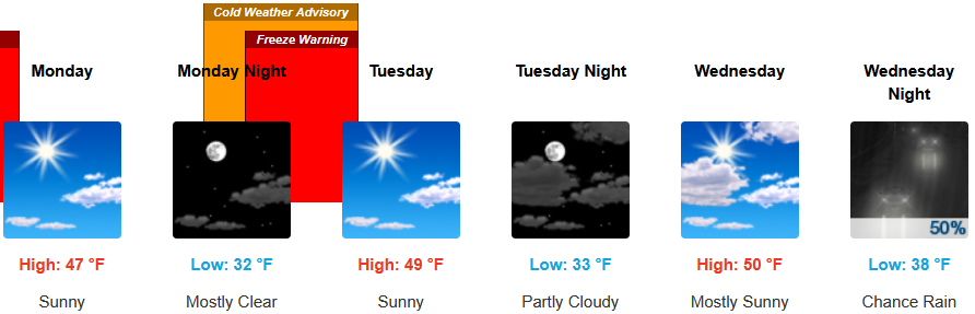
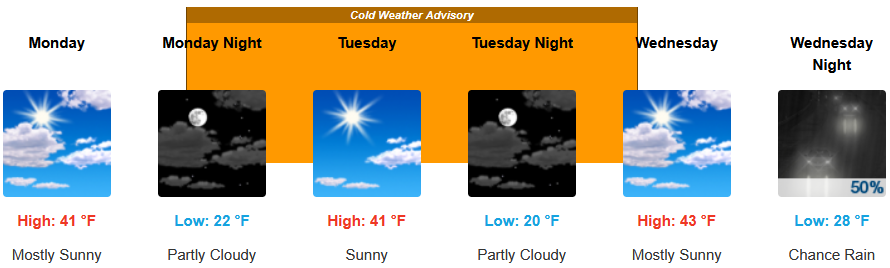
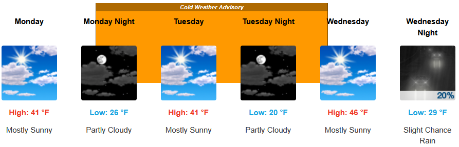
With Freeze Warnings and Cold Weather Advisories issued for much of southern Oregon through Tuesday morning, cold air is expected to dominate the forecast for the work week with changes forecast as soon as Wednesday after the period of calm weather, light winds and valley fog/low clouds moves to the east.
Inland areas are forecast to see the recent weather pattern into mid week before chances of precipitation begin to move into the area. Low temperatures are expected to range from the low 20’s to low 30’s with afternoon highs only getting to the mid to the low 40’s.
Along the coast, cold air continues to dominate the forecast to start the work week with increasing clouds beginning to build late Tuesday with a slight chance of rain Wednesday. Temperatures are forecast to be in the mid to upper 40’s for afternoon highs with lows cooling to the low to mid 30’s through midweek.
Brookings:
Crescent City:
Gold Beach:
Port Orford:
Cave Junction:
Grants Pass:
Medford: