

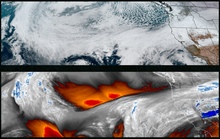
Unsettled weather and cold air are forecast to continue across the northwest with an atmospheric river impacting northern California and southern Oregon with heavy rain expected into next week with Freeze Warnings and Winter Weather Advisories issued by the National Weather Service.
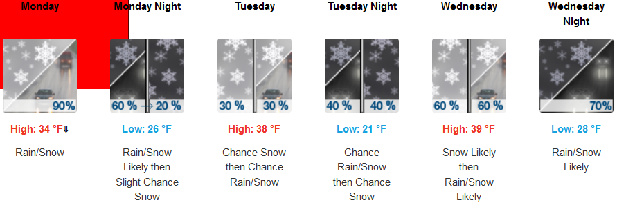
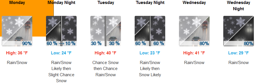
Inland areas are expected to see rain an snow to start the workweek and continuing through mid week with snow levels reaching the valley floor. Low temperatures are expected to range from the upper 20’s to mid 30’s with afternoon highs only getting to the mid to upper 30’s.
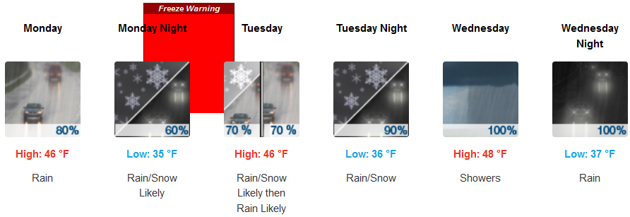
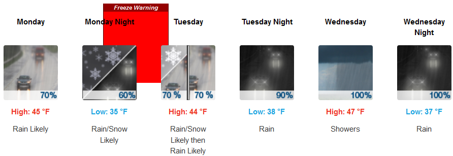
Along the coast, rain is expected to impact much of the area with southern Oregon at the top edge of the atmospheric river affecting northern California with snow levels dropping as low as 600ft late Monday into Tuesday. Temperatures are forecast to be in the mid 40’s for afternoon highs with lows cooling to the low to upper 30’s through midweek.
Brookings:
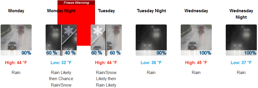
Crescent City:
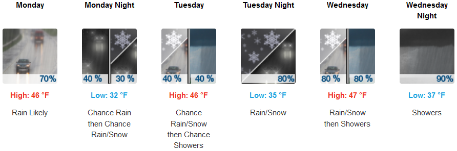
Gold Beach:
Port Orford:
Cave Junction:

Grants Pass:
Medford: