


The US National Weather Service is advising that a well-established moisture plume, or “Atmospheric River” from the subtropical Pacific Ocean is now beginning to impact the region as it pushes into north-west California and southern Oregon.
This will lead to periods of moderate to heavy rain through Saturday. Heaviest rain will be on Friday and Friday night. Expect rapid rises in rivers Friday through Saturday.
Two storm systems will arrive back to back and bring periods of heavy rain to southern Oregon and northern California over the next several days. Snow levels will quickly rise to about 8000 feet early on Thursday and will linger there through Saturday before falling to around 5000 feet. This heavy rain will create the possibility for landslides and debris flows, rapid river rises and urban and small stream flooding.
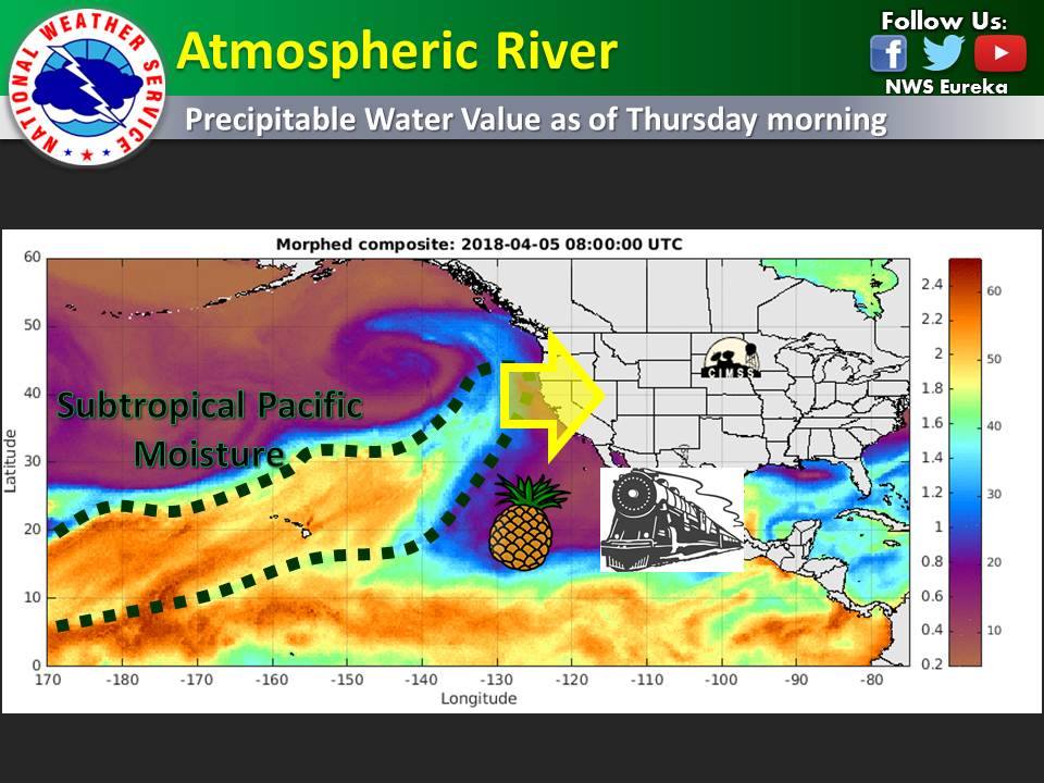
It is worth noting that this system is rather unusual for this time of year and will provide many places east of the Cascades, particularly for Modoc County, most of their usual April monthly rainfall in 3 days.
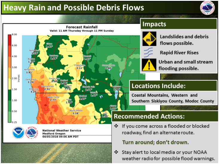
If you come across a flooded roadway, find an alternate route. Remember to turn around, don’t drown. Stay tuned to local media or your NOAA weather radio for possible flood warnings.
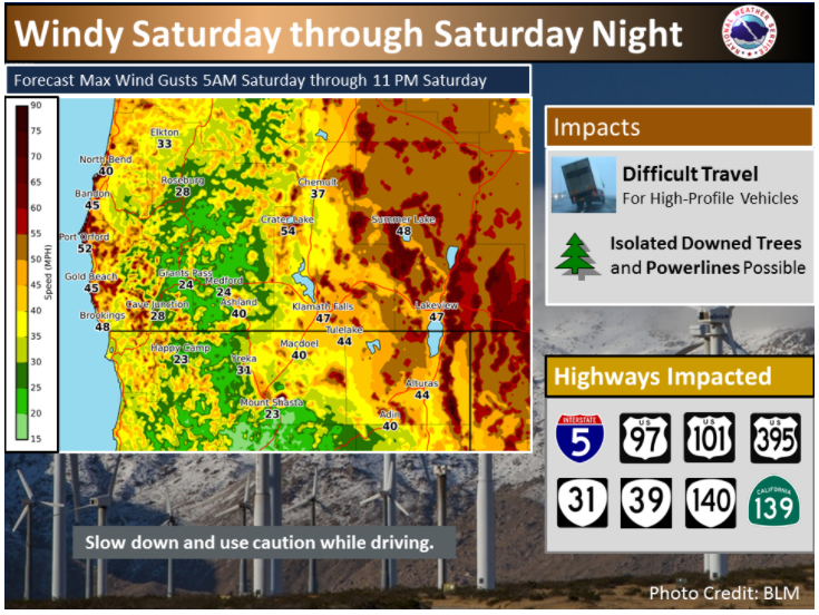
Be sure to check road conditions before venturing out. You can call 511 for Oregon road conditions and for California road conditions call 800-427-ROAD (7623) or visit their websites listed below.
Please Like, Share and Follow the …
![]()