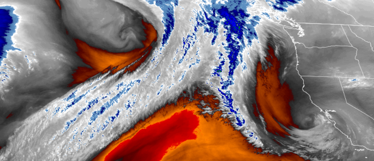
High pressure circulating off the central to southern California coast has pushed weather systems north of Oregon for several days, and as the system slowly drops further to the south and east, systems moving in from the north pacific will begin to push south enough to bring precipitation.
However, the forecast for the remainder of the work week and into the week end is for the southern Oregon and northern California regions to continue to see much of the same into early next week.

Cold temperatures will continue across the region, with early morning lows getting down to upper 20’s in some inland locations but only getting as low as upper 30’s along the coast. Afternoons will see increased cloudiness late Friday and Saturday, clearing to mostly clear skies late in the weekend with highs reaching 60 in some areas.
Brookings:

Crescent City:

Gold Beach:

Cave Junction:

Grants Pass:

Medford:


