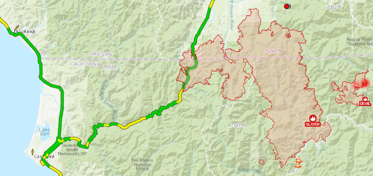
After three days of hot dry weather, red flag warnings, and dry powerful winds, the work put in by fire crews when cool wetter weather prevailed almost a week ago has virtually halted the Happy Camp/Slater Fire in tracks.
The fire lines continue to hold well with minimal movement and growth observed as the Happy Camp/Slater Fire could add only 43 new acres since Monday, and as of Wednesday’s official report now sits at 154,145 total acres and 45% containment. The Devi Fire remains at 8,410 total acres adding no growth and is now 20% contained.

In both the north and south, the primary work for firefighters is mop-up, patrol, and securing the fire’s edge as fuels continue to dry. Crews will continue to monitor and build a containment line from the Oregon/California border on the west side of Highway 199 east to the Sucker Creek area and firefighters are using direct and indirect attacks to tie in the remaining isolated hotspots west of Hwy 199.

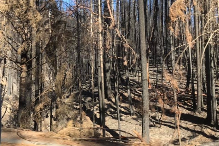
(Courtesy Caltrans Maintenance Supervisor Johnnie James)
The area north of Sanger Lake is being scouted for possible direct firelines. Firefighters are mopping up and holding Knopki Creek as well as areas south of Holland Loop along Althouse Creek Rd. Crews are also tying in and securing firelines from Hwy 199 into the Illinois Valley along the northwest flank of the fire.

The contingency line at Oregon Caves National Monument is nearly complete. Crews continue to work down the left fork of Sucker Creek and around Swan Mountain, building firelines along the northeast perimeter and down the east flank.

In the Elk Creek drainage and Browntown area, crews continue to go direct and construct containment line as close to the fire as they can. Over the next several days, small firing operations may be used to clean up fuels between the main body of the fire and the constructed fire line in the Monkey Creek Ridge area, the area south of Browntown to Number Eight Gulch, and along the east side of the fire.
Crews in the Happy Camp area continued to patrol and mop-up along the fire line focusing on mop-up and patrol of containment lines around Happy Camp, along Hwy 96, and along the southwest perimeter of the fire. Direct line construction and road prep is continuing above Thompson Creek on the east side, moving north to meet the crews moving south from Sucker Creek and Swan Mountain. Crews are working from both the north and the south on hazard tree mitigations along Grayback Rd.

Aerial water drops were used along the north edge of the Devil fire to help with hotspots. Firefighters continue to mop-up, patrol, and secure the fire’s edge. Contingency lines are in place. The south edge of the fire has containment line from the Pacific Crest Trail towards Fort Goff Creek.
Evacuation status is being lifted for all residents located on the following road systems including secondary roads: All residents living on Highway 199 from mileposts 34 to 38.5 including connecting County Roads, Waldo Road from 900 Waldo Road to 3200 Waldo Road, Wood Creek Road from Waldo Road to Shepherd Hill Road. All residents on Rockdale Road, including those living on connecting county roads, Holland Loop Road from Caves Highway to Hayes Cut-Off Road, Holland Loop Road from 8000 Holland Loop Road to Caves Highway, White House School Road and those living on connecting county roads.
Evacuation Levels have been downgraded from a Level 2 “Be Set” to a Level 1 “Be Ready” for all residents living directly on US Highway 199 between Milepost 38.5 and the Oregon State line.

The current Level 3 “Go” evacuation level is being downgraded to a Level 2 “Be Set” for the Oregon Caves National Monument.
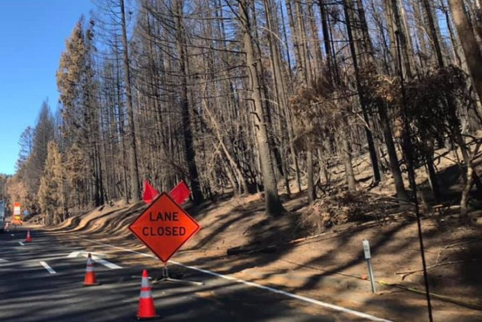
U.S. Highway 199 continues to remain open to two-way through traffic in both California and Oregon. Drivers are reminded to use caution and slow for fire crews maintenance crews and law-enforcement and to be prepared for possible delays as fire conditions are ever-changing.


