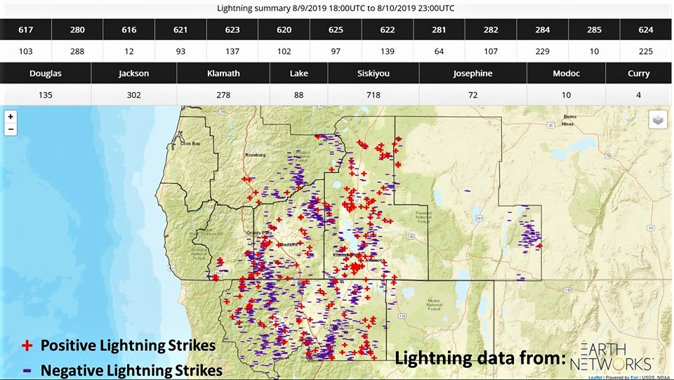
According to the US National Weather Service in Medford Oregon, 1607 cloud to ground lightning strikes were observed over their nine-county forecast area.
The National Weather Service confirmed Wednesday that a weak tornado touched down at approximately 4:00pm in Klamath County Tuesday afternoon. No damage or injuries were reported.
The weather system that had the potential to produce numerous fires with lasting impacts to southwest Oregon came with more precipitation than expected, resulting in approximately 13 small fires on the Rogue River-Siskiyou National Forest. The fires were promptly contained and extinguished during initial attack efforts. Most of the starts were located in Jackson County, with a couple located in Josephine County.

A significant amount of lightning activity was received on the south and east sides of the forest on Friday, but it came with significant precipitation. Very little lightning activity was received on Saturday, with additional precipitation received. Scattered precipitation has averaged 1” rain received across the forest at the various weather stations.
Temps will increase up to the 90s in the valleys and mid-80s at higher elevations starting on Monday. There is a potential for holdover fire starts associated with the lightning activity as forest fuels dry out. Aerial reconnaissance flights will continue to monitor for smokes as needed, and as weather conditions allow for flights. All fire tower lookouts are currently staffed across the Rogue River-Siskiyou National Forest.


