


The Milepost 97 fire, located about 1 mile southeast of Canyonville was reported Wednesday, July 24th at approximately 10:00 p.m. The fire is burning in steep, rocky terrain with limited access. Currently, the Milepost 97 Fire is burning in an old fire scar that originally burned in 1987.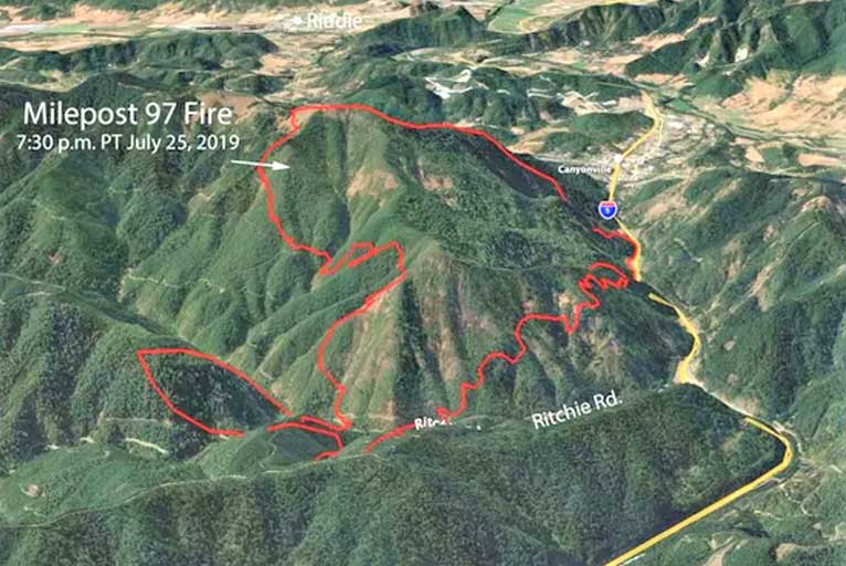
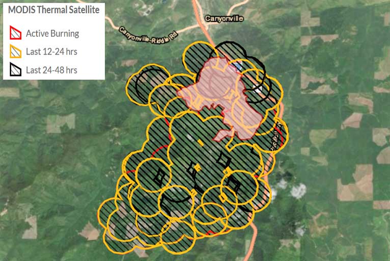
Active fire behavior continues to be observed on the Milepost 97 fire, which is now estimated to be 6,000 acres in size after adding over 4,200 acres Friday. The majority of the fire growth has been to the south / southwest of the original fire and is burning through a mixture of private industrial timberlands, O&C Lands Managed by the Bureau of Land Management, and lands held in trust by the Bureau of Indian Affairs for the Cow Creek Tribe.
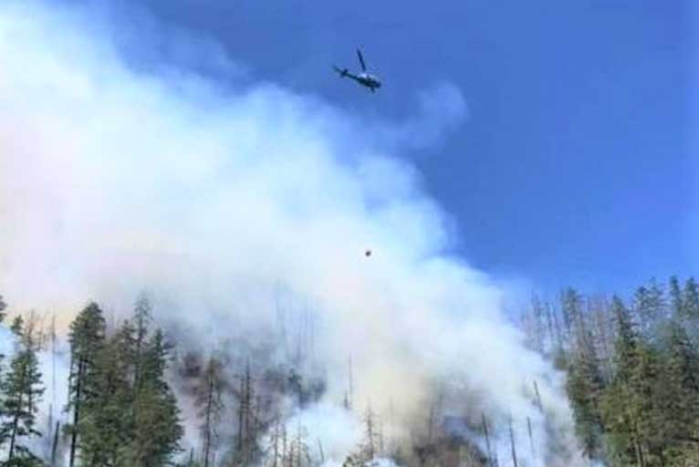
Both ground and aviation resources are currently engaged on the fire with seven helicopters, two large air tankers and two single-engine air tankers supporting firefighters on the ground. Additional aviation resources and ground resources in the form of hand crews, engines, and heavy equipment have been ordered and are en route to the incident.
The Oregon Department of Forestry’s Incident Management Team 3 arrived in Roseburg Friday afternoon and were briefed on the status of the Milepost 97 Fire by representatives from the Douglas Forest Protective Association and the Bureau of Land Management. In addition, industrial landowners, tribal representatives, and other local, county, state, and federal agencies were at the in-briefing.
The Oregon Department of Forestry’s Incident Management Team 3 will assumed command of the Milepost 97 Fire at 6:00 p.m. Friday night. The objective set forth for the Incident Management Team is to extinguish the fire at the smallest footprint possible. Safety for the general public and firefighters is always the number one priority.
Please Like, Share and Follow the …
![]()